

East Potomac Park and Hains Point
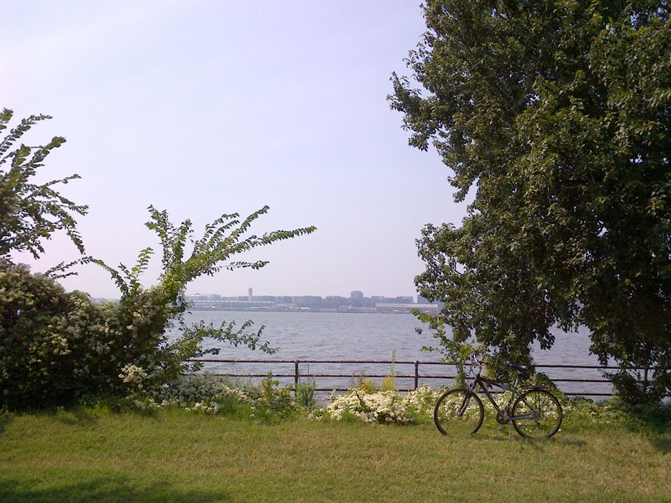
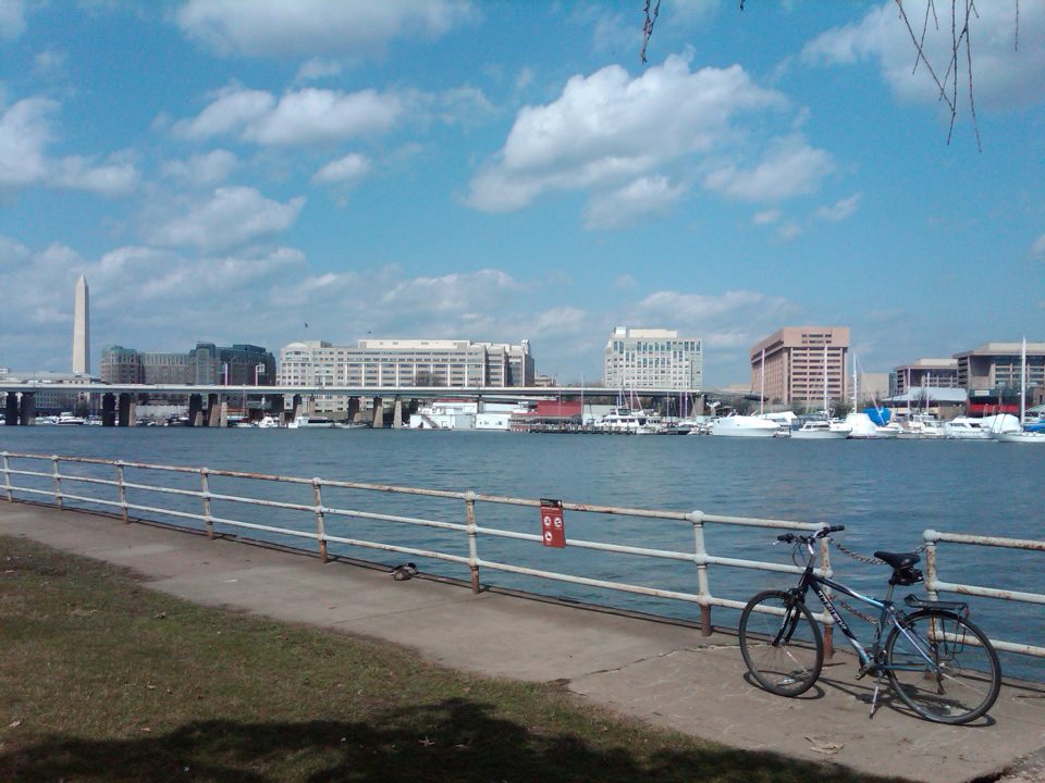
East Potomac Park is a section of Potomac Park located south of the Jefferson Memorial and the 14th Street Bridge, and sits on a peninsula that drives a grassy wedge between the Washington Channel and the Potomac River on the south side of the Tidal Basin (MAP). The 328-acre finger of land is bordered on the east by the Washington Channel, on the west by the Potomac River, Hains Point at the southern end, and is separated from West Potomac Park by the iconic Jefferson Memorial.
The peninsula on which the park is located was created by the U.S. Army Corps of Engineers. After a disastrous flood in 1881, the Corps of Engineers dredged a deep channel in the Potomac and used the material to create the current banks of the river and raise much of the land near The White House and along Pennsylvania Avenue. Much of the dredged material was also utilized to build up existing mudflats in the Potomac River as well as sandbars which had been created by resultant silting, including the peninsula which led to the creation of Potomac Park on March 3, 1897.
In addition to providing terrific views of the city, East Potomac Park also features many of Washington’s famous Kanzan cherry trees. These double-blossoming cherry trees line Ohio Drive and bloom about two weeks after the single-blossoming Toshino variety that attracts throngs of tourists to the cherry blossoms around the Tidal Basin during the National Cherry Blossom Festival each spring.
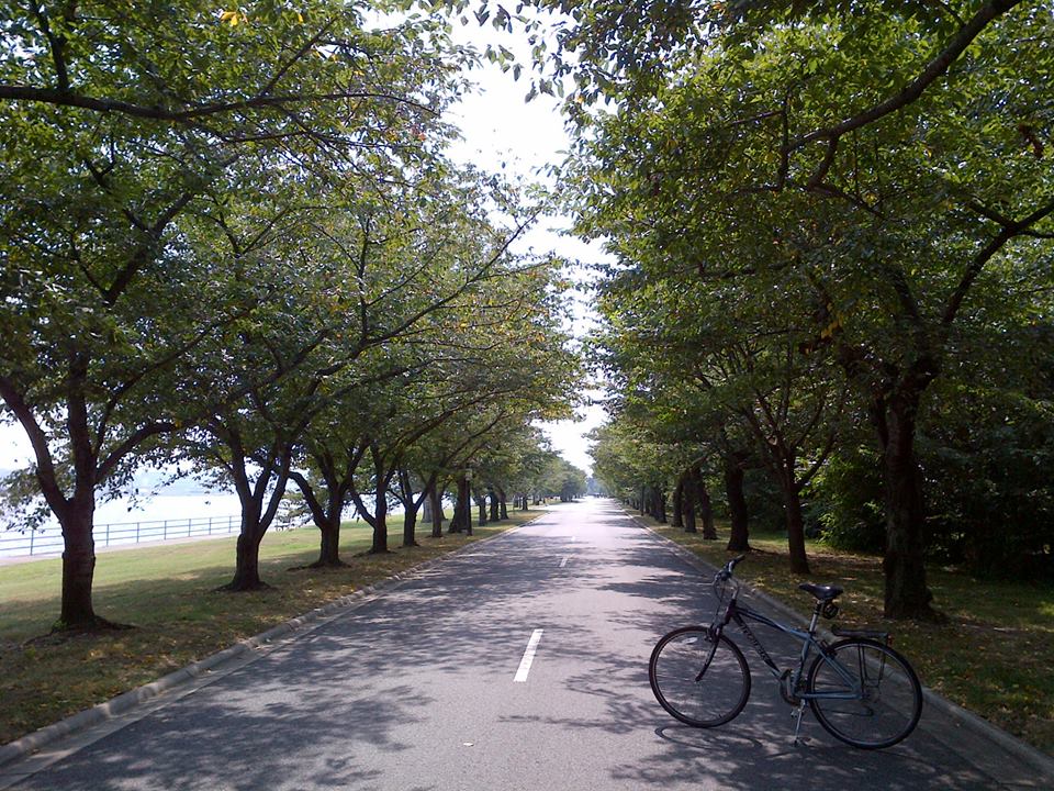
Ohio Drive, which is a six-mile loop that runs the perimeter of East Potomac Park, is a popular route with bicyclists, runners and walkers, and inline skaters. And a scenic riverfront sidewalk, which winds around the park’s shoreline, remains a popular place for fishing, despite falling apart and literally sinking into the river in places. The park is also home to one 18-hole and two 9-hole public courses at the East Potomac Park Golf Course, a driving range and a miniature golf course, a public swimming pool (the East Potomac Park Aquatic Center), tennis courts, picnic facilities, a playground, and a recreation center.
The southern end of the park at the end of the peninsula is known as Hains Point. This location offers stunning views of the river, as well as Fort McNair and the National War College in D.C. to the east. To the west, visitors can watch planes take off and land at Ronald Reagan Washington National Airport, located across the Potomac River in Virginia. Hains Point was also formerly the home of a popular public artwork entitled “The Awakening,” a 70-foot sculpture depicting the arousing of a bearded giant who is embedded in the earth. However, the sculpture was sold in 2008, and the new owner moved it to its current location at National Harbor in Prince Georges County, Maryland.
It is rare for anything in D.C. to lack controversy or intrigue, and East Potomac Park is no exception. In 2004, an area of four acres adjacent to the National Park Service offices at Ohio and Buckeye drives was enclosed by a 10-foot high security fence and large beige metal buildings were constructed. The action, initiated by the U.S. Navy, bypassed normal multi-agency review procedures usually required for the use or taking of Federal parkland. The Navy, which operates the site, calls the work a “utility assessment and upgrade” and will not say if the project is classified or whether it has a name. Nor will the Navy say how much it cost, how many people were on the job or why it was needed.
When questioned about activity at the site, D.C.’s non-voting delegate in the House of Representatives, Eleanor Holmes Norton, advised that she “is aware of what’s going on but cannot comment.” Similarly, Frederick J. Lindstrom, acting secretary of the U.S. Commission of Fine Arts, advised that he had been advised that it would be illegal for him to discuss the matter. Lindstrom went on to state, “Let’s just say when they’re finished, you’ll be glad they’ve done what they’ve done.”
Athough the Navy originally advised that work at the complex would last approximately four years, a decade later the ongoing activity and construction that goes on inside the security fence, involving regular arrival and departure of dump trucks, remains a mystery. Amid the secrecy, theories about the four-acre complex and hangar-like structures abound. In a city which contains radiation tracking instruments atop the Federal Reserve building, biowarfare sensors analyzing the air on the National Mall in front of the Smithsonian Institution castle, and antiaircraft systems on a rooftop next to the White House, the Navy’s secretive activity on East Potomac Park is presumed by many to be related to national security.
Although we may never know the details of the Navy’s activity there, that should not prevent visitors from enjoying the remaining 324 acres of this active yet pastoral park.


Is there a trail to bike, skate on or do you share the road?
LikeLike
You share the road, but the layout of the road (Ohio Drive) and the fact that there are so few vehicles make it very safe. It is even more safe on the weekends, when the road is closed to cars and available only to bike riders, skaters, and joggers/walkers.
LikeLike