Posts Tagged ‘Potomac Heritage National Scenic Trail’

NeabscoBoardwalk (1)

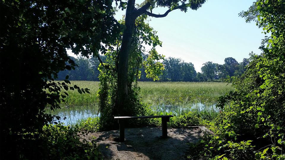
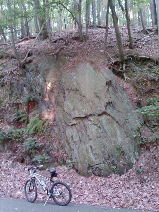
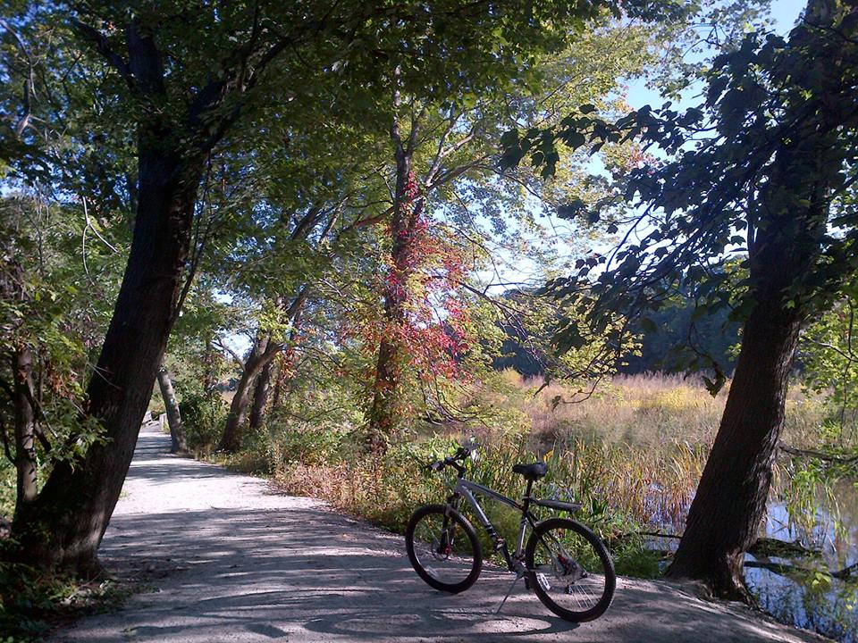
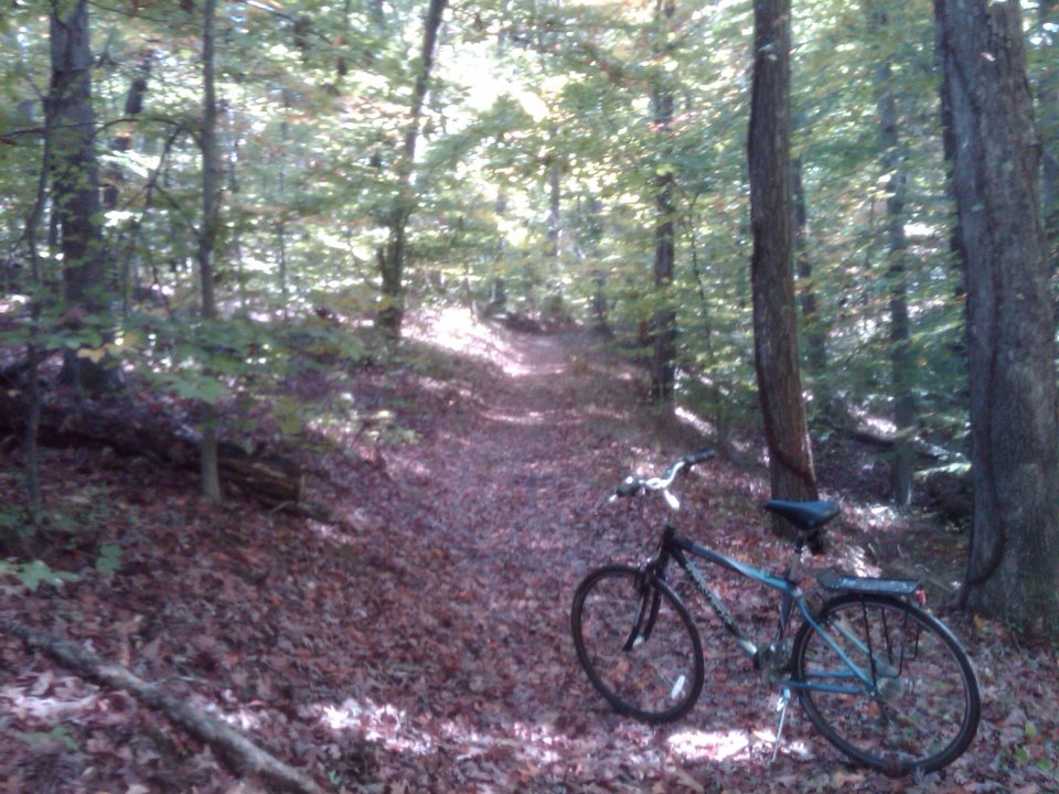
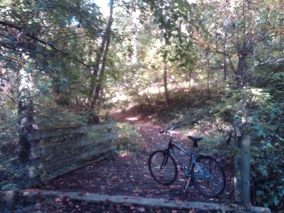
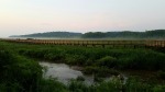
For this long holiday weekend I decided to get away for a little while.  And there is such a diversity of things to see and do in the local area that it doesn’t take a lot of effort to experience something new and different.  So this morning I went for a bike ride at the newly-built Neabsco Creek Boardwalk, located about 30 miles south of D.C. on the Potomac Heritage National Scenic Trail at 15125 Blackburn Road in Woodbridge (MAP), Virginia. 

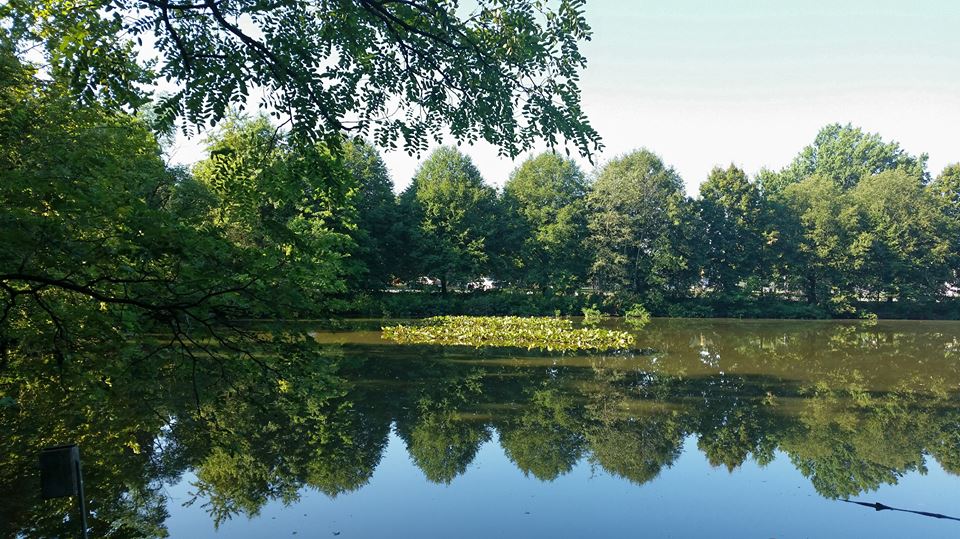
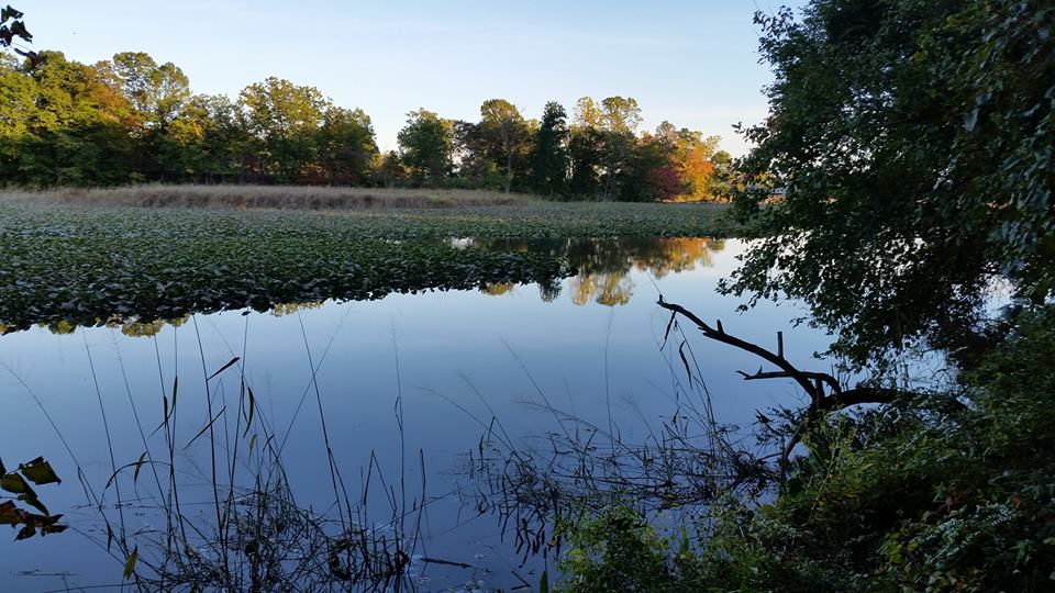
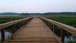
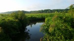
The three-quarters of a mile long, 10-feet wide boardwalk, which includes a two-story observation deck, opened just last month.  It traverses Neabsco Creek, and allows bikers and hikers access to wetlands where the tall grasses and marsh filter pollution from the river and provide a rich habitat for great blue herons, wood ducks, mallards, sparrow and red-winged blackbirds, just to name a few of the winged wildlife known to populate the area.

The 3.8 million dollar boardwalk is designed to showcase Woodbridge’s most valuable natural asset — the Potomac Waterfront.  The boardwalk is compliant with the Americans With Disabilities Act, and encompasses educational sites that highlight information on native wildlife and plants.  Guided tours are also occasionally offered.

The Prince William Board of County Supervisors recently voted to combine the Neabsco Creek Boardwalk with the Julie J. Metz Wetlands Park, the Rippon Lodge Historic Property, Kings Highway, the Potomac Heritage National Scenic Trail and Rippon Landing Neighborhood Park, and designated the combined recreation and historic sites as the Neabsco Regional Park.


[Click on the photos to view the full-size versions]

NeabscoBoardwalkAir01

Aerial view of the boardwalk, courtesy of Prince William County.

newschoolbaptist01

New School Baptist Church

I almost always go for an extended bike ride on long holiday weekends.  And although this weekend was not a long one, when it’s February and the temperature is in the upper 70’s here in the D.C. area it’s impossible to stay inside.  So I took one of my recumbent bikes and went for a long, leisurely ride this weekend.  And during the ride I happened upon the historic site of the New School Baptist Church, which is located along The Potomac Heritage National Scenic Trail at 15557 Cardinal Drive (MAP) in Dale City, Prince William County, Virginia.

According to the historic marker it was the site where slaves from plantations in the area “gathered between 1861 and 1865.  They built a brush arbor church, worshipped God and became a faithful congregation.  On December 5, 1881, Reverend John L. Bell and four other church leaders purchased one acre of this land for eleven dollars and called themselves the New School Baptist church.  George W. Thomas helped erect a wooden, steepled church which was renamed Neabsco Baptist Church.  The building was used also to educate children of former slaves and free persons of color.  This church has undergone two renovations.  Hand-hewn timbers below the flooring of the present church are silent reminders of the toll of many persons who held a dream during troubled times.”

While I was there I also ventured behind the church where the church’s historic cemetery is located.  There are headstones there that are so old that the names and dates are worn away.  The cemetery also proudly has the grave of a World War I veteran, Owen Thomas, whose family members still attend the church.

Neabsco Baptist Church has undergone many changes throughout its history and is about to undergo another major change.  On six acres of recently-purchased land adjacent to the existing church building they are curretly building a new and much larger sanctuary to accommodate its growing and dynamic congregation.  Even with its long history it’s pastor, Pastor Joshua Speights, Jr., feels some of the best days for the church are still ahead.  So it appears that the 156 year-old church will continue to make history well into the future.

newschoolbaptist02     newschoolbaptist04     newschoolbaptist03
[Click on the photos to view the full-size versions]

PotomacHeritageTrail01a

The Potomac Heritage National Scenic Trail

I took advantage of the mild weather preceding the storm expected for this weekend and went for an early morning ride today on a scenic portion of one of the southern sections of the Potomac Heritage National Scenic Trail.  The part of the trail where I explored this morning is located about 20 miles south of D.C., between the northern edge of the Julie J. Metz Wetlands Bank just south of Neabsco Creek, and the Occoquan Bay National Wildlife Refuge, in Prince William County, Virginia (MAP).

The trail, also known as the Potomac Heritage Trail or the PHT, is a designated National Scenic Trail corridor spanning parts of the mid-Atlantic and upper southeastern regions of the United States. It is comprised of a network of trails that will eventually connect numerous historic and cultural sites and natural features of the Potomac River corridor in D.C. and the local surrounding area, as well as in the Upper Ohio River Watershed in Western Maryland and Pennsylvania, and a portion of the Rappahannock River Watershed in Virginia.

Unlike many long-distance hiking and biking trails, such as the Appalachian Trail (which the PHT crosses near Harper’s Ferry, West Virginia), the PHT is a general route with numerous side trails and alternative routes.  Some of the routes even run parallel to each other, such as the Northern Neck Heritage Trail in Virginia and the Southern Maryland Potomac Heritage Trail, which parallel each other on opposite sides of the Potomac River.  The PHT includes approximately 800 miles of existing and planned future sections which, when completed, will all be connected. However, at the present time many of these trails and routes are still separated, connected to the others only by roads.

Development, construction, maintenance and preservation of the natural surface portions of the PHT is sponsored by The Potomac Heritage Trail Association in cooperation with other trail advocacy groups, as well as support from the National Park Service and the Northern Virginia Regional Park Authority.   Among the trail advocacy organizations are a number of local groups and clubs, including the Potomac Appalachian Trail Club; Great Falls Trail Blazers; Fairfax Trails and Streams; Southern Prince George’s Trails Coalition; and the Oxon Hill Bicycle Club.

The PHT network follows some of the original paths once explored by George Washington, and you can follow the same routes today.  Whether by bike, on foot, or by horse or boat, the PHT provides almost limitless opportunities to explore the contrasting landscapes between the Chesapeake Bay and the Allegheny Highlands, and the many historic sites in between.  But if you’re looking for biking opportunities on the PHT which are closer to D.C., try exploring the The C & O Canal Towpath and the Mount Vernon Trail.

PHNST01     phnst02a     PHNST11

PHNST03     PHNST04     PHNST05

phnst05a     phnst04a     phnst01a

PHNST07     PHNST06     PHNST08
[Click on the photos above to view the full size versions]

OccoquanPark08

Occoquan Regional Park

I like to take advantage of the opportunities long holiday weekends provide to venture out from D.C.’s city limits and visit some of the places in the metro area which are not as easily travelled to during a workday lunch hour bike ride.  For this Labor Day weekend, I decided to go for an early morning ride and visit Occoquan Regional Park.

Administered by the Northern Virginia Regional Park Authority, Occoquan Regional Park is located at 9751 Ox Road, in Fairfax County, Virginia (MAP).  It is situated on the banks of the Occoquan River, a tributary of the Potomac River, and is directly across from the Town of Occoquan, which is in neighboring Prince William County.  The park is composed of approximately 400 acres of recreational space which is comprised of dense forests as well as open spaces, and includes picnic shelters and gazebos, soccer and baseball fields, volleyball courts, a batting cage, and a marina with a fishing pier, sundeck, boat launch and kayak rentals.  And although it is not mentioned on the park’s website or in any guidebooks, it is one of my favorite places to pick wild blackberries.

The park also contains several attractions of historical significance, including preserved Civil War arsenals, the site of the Women Suffrage Prison at Occoquan Workhouse, and the Lorton Prison Beehive Brick Kiln.  The prison was in operation in 1917, and housed women who dared to speak out in favor of the right to vote for women.  It even house women picketers who were arrested in front of The White House.  And the kiln was in operation from the turn of the century until the late 1960’s, and was a primary local source of the red bricks used in constructing many of the historic buildings which can be seen throughout Northern Virginia.  I hope to visit these places and learn more about them in the future.

And last but not least, the park contains not only a paved cycling trail, but is also one of the few places in the region to serve as a trailhead for and site within multiple routes of regional and national significance.  These include: Park lands, trails and associated waters that are part of the Fairfax Cross-County Trail; the diverse, braided network of the Potomac Heritage National Scenic Trail; an historic journey commemorated by the Captain John Smith Chesapeake National Historic Trail; and the Occoquan Water Trail, recognized as both a National Recreation Trail and part of the Chesapeake Bay Gateways and Water Trails Network.

With all that is has to offer, Occoquan Regional Park serves not only as a destination in and of itself, but as a starting point as well.

OccoquanPark09     OccoquanRegionalPark03a     OccoquanRegionalPark01a

OccoquanTown04     OccoquanPark03     OccoquanPark01

OccoquanPark02     OccoquanPark05     OccoquanPark04     OccoquanPark06
[Click on the thumbnails above to view the full size photos]

Veterans Memorial Regional Park

Veterans Memorial Regional Park

Today is Veterans Day, a Federal holiday observed annually on November 11th which is intended to honor all men and women who have served in the U.S. Armed Forces. It is one of ten official Federal holidays. Since I was given the day off from work, I took advantage of the opportunity and ventured away from the city to explore one of the regional or state parks in the D.C. metro area. So for a Veterans Day ride, I selected Veterans Memorial Regional Park, located at 14300 Veterans Drive in Woodbridge, in nearby Prince William County, Virginia (MAP).

The park is home to several sports leagues including swimming, soccer, football, baseball, softball, Little League baseball, basketball, and volleyball. The community center hosts open gym days for both basketball and indoor seasonal, as well as dance classes sports classes, playschool, summer and mini-camps. The park also boasts a large skate park which features a 6,300-sq. ft. concrete course, a vertical ramp half-pipe, and a 60-ft long kidney bowl for a challenging ride. The multifaceted park also includes a 50-meter outdoor pool, as well as concessions, outdoor grills, picnic tables, volleyball, basketball courts, tennis courts, horseshoe pits, pavilion rentals, and restrooms throughout the park.

But my favorite aspect of the park is the fact that the Potomac Heritage National Scenic Trail runs through it, with a trail entrance just off the main road that runs through the park. Available to hikers and bike riders, the trail head is marked by the green square on a post. The trail runs through some of the natural areas of the park, which is situated adjacent to the beautiful Marumsco Creek, Featherstone National Wildlife Refuge, and Occoquan Bay National Water Reserve.

Having a paid day off from work is always nice, but going for a long, leisurely bike ride in Veterans Memorial Regional Park made it even better.

VeteransPark03     VeteransPark12     VeteransPark07

VeteransPark05     VeteransPark08     VeteransPark09

Fort Circle Park National Recreation Trail

Fort Circle Park National Recreation Trail

The Fort Circle Trail is what’s known as a hiker-biker trail, and follows along part of a route connecting historic sites that are collectively known as The Civil War Defenses of Washington.  The seven-mile trail passes through four of D.C.’s dozens of Civil War era forts which were originally built to defend bridges, naval installations, Capitol Hill and the rest of the city from likely approaches by Confederate rebels through southern Maryland during the Civil War.  Trail end points are at Bruce Place (Fort Stanton) in southeast D.C. (MAP), where I entered the trail on this ride, and at 42nd Street (Fort Mahan) in northeast D.C., where I ended.

The Fort Circle Trail contains surprising expanses of natural open spaces in what is otherwise a highly urban area.  It runs along the traces of old roadways, as well as through forests which are thick with oaks, beech, maples, and pine.  It can also get overgrown with vegetation at times along the route.  There are a few busy road crossings too, and navigating the starts and stops can sometimes get tricky if a rider is not paying attention.  The trail’s surface is mostly natural earth, with some improved sections which are paved with asphalt.  Be aware that the natural surface areas can also get muddy after heavy rains.  But the trail is signed in most places and easy to follow.

The Fort Circle Park National Recreation Trail was designated in June of 1971, and was one of the first National Recreation Trails.  It is administered by the National Park Service, and is part of the larger American Discovery Trail as it winds its way from Chesapeake Bay to Georgetown, as well as the Potomac Heritage National Scenic Trail, whose 425 miles of trail stretch between the Chesapeake Bay and the Allegheny Highlands.

The Fort Circle Park National Recreation Trail is unique in that it is the only natural-surface trail within the D.C. city limits that allows mountain bikes.  In fact, a good way to see the trail is on mountain bike guided tours that are offered on the last Saturday of the month during warmer weather, and are lead by a Park Service ranger.  And if you don’t have a bike, the National Park Service will even provide one for you with advanced notice.

Whether you happen upon it like I did and explore the trail at your own pace, or plan ahead and take a tour guided by a ranger from the National Park Service, the Fort Circle Trail is unique among D.C.’s many trails, and worth experiencing in whatever way you choose.

FortCircle04     FortCircle02     FortCircle05

Fort Circle Park National Recreation Trail      Fort Circle Park National Recreation Trail     FortCircle01
[Click on the photos to view the full-size versions]