I’m not a fanatical cyclist. I'm not a professional writer or photographer either. I’m just a guy who began this blog when I was working in Washington, D.C., and used my lunch break each day to go for a bike ride and discover some of the eclectic sites and events in and around the city. Now I’m retired and I still ride. But now I can ride whenever I want. I take a few snapshots along the way, and then use this blog to post the photos and write about what I see, what I learn, and what I think about while I continue to explore our nation's capital one ride at a time.
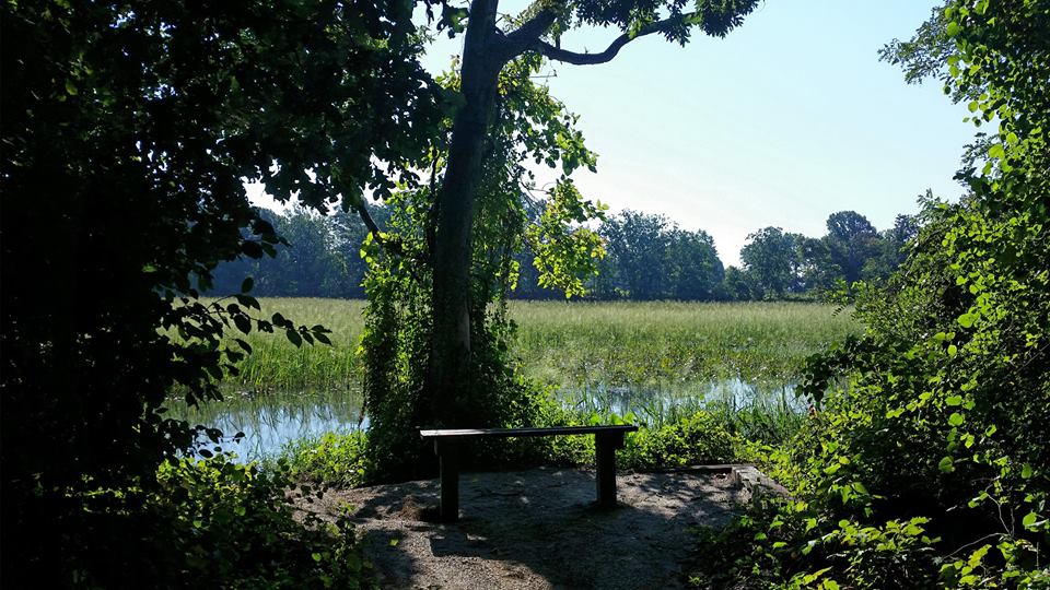
For this long holiday weekend I decided to get away for a little while. And there is such a diversity of things to see and do in the local area that it doesn’t take a lot of effort to experience something new and different. So this morning I went for a bike ride at the newly-built Neabsco Creek Boardwalk, located about 30 miles south of D.C. on the Potomac Heritage National Scenic Trail at 15125 Blackburn Road in Woodbridge (MAP), Virginia.
The three-quarters of a mile long, 10-feet wide boardwalk, which includes a two-story observation deck, opened just last month. It traverses Neabsco Creek, and allows bikers and hikers access to wetlands where the tall grasses and marsh filter pollution from the river and provide a rich habitat for great blue herons, wood ducks, mallards, sparrow and red-winged blackbirds, just to name a few of the winged wildlife known to populate the area.
The 3.8 million dollar boardwalk is designed to showcase Woodbridge’s most valuable natural asset — the Potomac Waterfront. The boardwalk is compliant with the Americans With Disabilities Act, and encompasses educational sites that highlight information on native wildlife and plants. Guided tours are also occasionally offered.
The Prince William Board of County Supervisors recently voted to combine the Neabsco Creek Boardwalk with the Julie J. Metz Wetlands Park, the Rippon Lodge Historic Property, Kings Highway, the Potomac Heritage National Scenic Trail and Rippon Landing Neighborhood Park, and designated the combined recreation and historic sites as the Neabsco Regional Park.
[Click on the photos to view the full-size versions]
Aerial view of the boardwalk, courtesy of Prince William County.
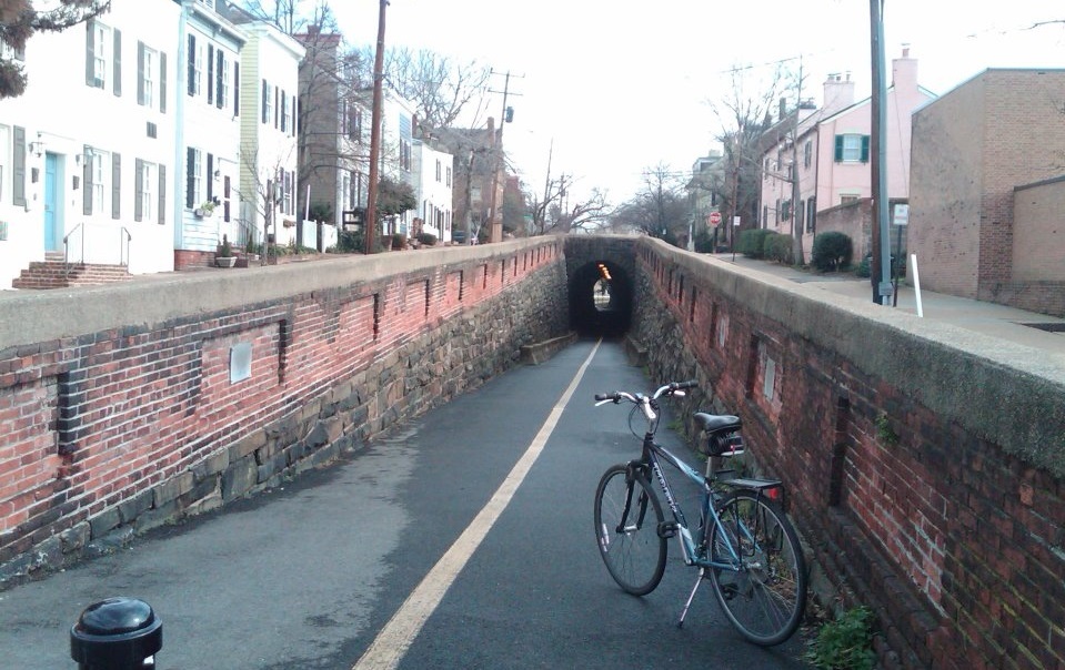
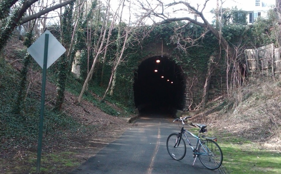
During all of my lunchtime bike rides over the past several years I have been able to enjoy hundreds of aspects of the city and surrounding area. From monuments and memorials to churches and cemeteries, there is always something interesting to discover and learn about. But on this ride I happened upon something that up until this point I had not seen before. As I was riding in Old Town Alexandria I happened upon an old underground tunnel.
Located near the eastern end of Wilkes Street (MAP), with an entrance to the west of Windmill Hill and Shipyard Parks, it turns out that it is the Wilkes Street Tunnel, which originally was a railroad tunnel used by Union troops during the Civil War to ship supplies from Alexandria to Richmond and points south. And I didn’t even have to wait until after my ride to learn about it because there is a plaque on the wall at the western end of the tunnel that provides its history.
The plaque reads, ” The Wilkes Street Tunnel was part of the Orange & Alexandria Railroad, founded in 1848 to promote trade with western Virginia. The Orange and Alexandria inaugurated its track in Alexandria on May 7, 1851 with a run to the north end of Union Street to the Wilkes Street Tunnel. Thus, the tunnel linked the railroad to warehouses and wharves along the waterfront. Located nearby, the Smith and Perkins foundry manufactured locomotives for the Orange and Alexandria and other railroads.
Wilkes Street Tunnel is typical of cut-and-cover tunnel construction. Presumably, the tunnel was cut through the bluff overlooking the Potomac River and covered to continue the streets above. After the sides were built up with stone, the arch probably was constructed over wood falsework from both sides using a centering technique to form the brick barrel vault. The tunnel was deepened after World War I to accommodate higher boxcars.
The Orange and Alexandria line was one of the many Alexandria railroads taken over by Union forces at the onset of the Civil War. While this northerly section of the railroad was incorporated into the U.S. Military Railroads, the length of track south of the Rappahannock River remained in Confederate hands.
Both sections played an major role in the strategies of North and South, as well as a decisive element in the Confederate victory at the Second Battle of Manassas or Bull Run. The Wilkes Street Tunnel gave Union Army access to the wharves for shipping military supplies on car ferries south of Aquia Creek, terminus of the Richmond, Fredericksburg & Potomac Railroad.
Shortly after the Civil War, the old Orange & Alexandria line was incorporated into the Washington City, Virginia Midland & Great Southern Railway controlled by the Baltimore & Ohio Railroad. Wilkes Street Tunnel played a part in the rivalry between the Baltimore & Ohio and Pennsylvania Railroads for supremacy in the north-south trade across the Potomac River. The Pennsylvania Railroad acquired Congressional authorization for exclusive use of Long Bridge (14th Street). To maintain a competitive position, Baltimore & Ohio offered trans-Potomac service by way of carfloats linking Wilkes Street with Shepherd’s Ferry on the Maryland shore until about 1906.
The Wilkes Street track continued in operation until 1975 when declining industrial activity along the waterfront no longer warranted rail service. The tunnel is significant today as Alexandria’s only 19th century transportation site surviving intact.”
The interior of the tunnel consists of dry-laid grey sandstone vaulted walls. Its dimensions are approximately 170 feet long with exterior stone and brick surfaces, and an interior consisting of grey sandstone masonry, with a 15-foot deck and an arch with a vertical clearance of 17 feet. The city completed a structural refurbishment of the tunnel in March of 2008, and a ribbon-cutting ceremony was held on March 11th. Today the tunnel is open to pedestrians and bike riders like me.
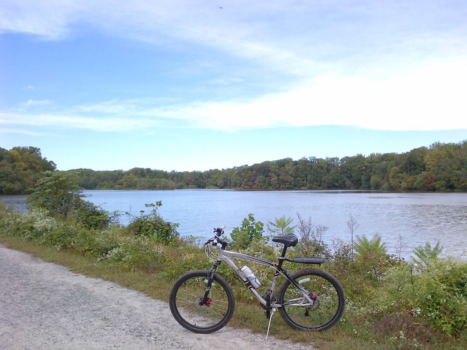
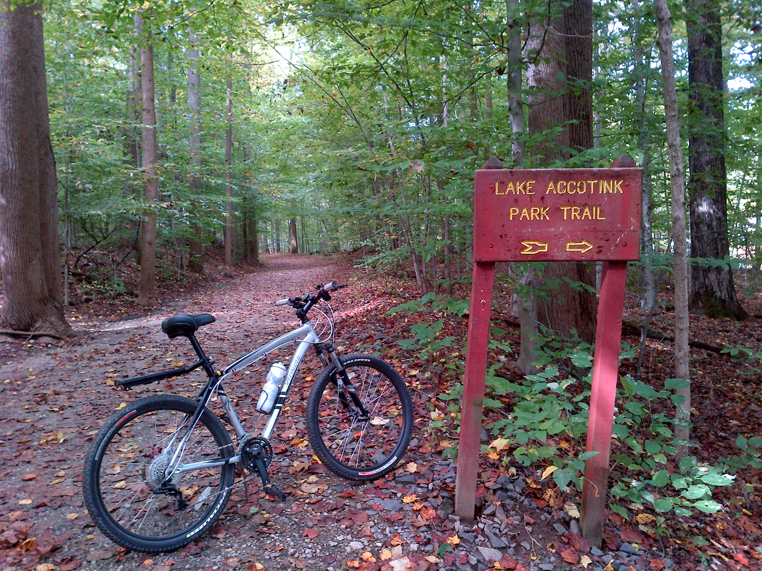
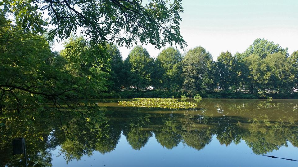
Long holiday weekends are always a great opportunity to venture outside of the city and go for a bike ride in one of the many nearby state, regional, or county parks and recreation areas. And on this early-morning, holiday weekend ride I rode the bike trail that goes around the lake at Lake Accotink Park, which is a multi-purpose park located at 7500 Accotink Park Road (MAP), just outside of D.C. in North Springfield, Virginia.
Lake Accotink is a reservoir in eastern Fairfax County, Virginia, which is formed by the damming of Accotink Creek. The 55-acre park surrounding the lake is maintained by the Fairfax County Park Authority. But the park was severely damaged not too long ago by flooding in the area. And although evidence of the damage can still be seen, the trails are usable again.
Running through the park is a trestle bridge for the Orange and Alexandria Railroad, which was an intrastate railroad in Virginia. The railroad extended from Alexandria to Gordonsville, with another section from Charlottesville to Lynchburg. The railroad played a crucial role in the Civil War, and eventually became an important part of the modern-day Norfolk Southern rail system.
A sign near the bridge reads, “The original bridge crossing the Accotink Creek was built in 1851 as part of the Orange and Alexandria Railroad. During the Civil War the wooden trestly was an attractive target for Confederate soldiers. In his 28 Dec 1862 raid on Burke’s Station, Confederate Major General J.E.B. Stuart sent twelve men to burn the trestle. Although termed an “inconsiderate structure” by the Union press, the raid was alarming to many because of its close proximity to Alexandria. The trestle was quickly rebuilt, allowing the Union to continue transporting vital supplies along the line for the remainder of the war.”
The park also has canoes, paddleboats, and rowboats available for rent. Visitors can also take a tour by boat. The park’s trail loop around the lake is a multi-use trail that accommodates bikes, as well as walkers and runners. And there are other trails that stretch beyond the park and connect to the Cross-County Trail, with its running trails and mountain biking trails. There is also a miniature golf course and an antique carousel near the south entrance to the park.
Accotink Park was one that I had not been to before, and I very much enjoyed the parts of the park that I saw. However, it is so big that there are still more parts to explore. So I guess I’ll just have to go back again soon.
[Click on the photos above to view the full size versions]
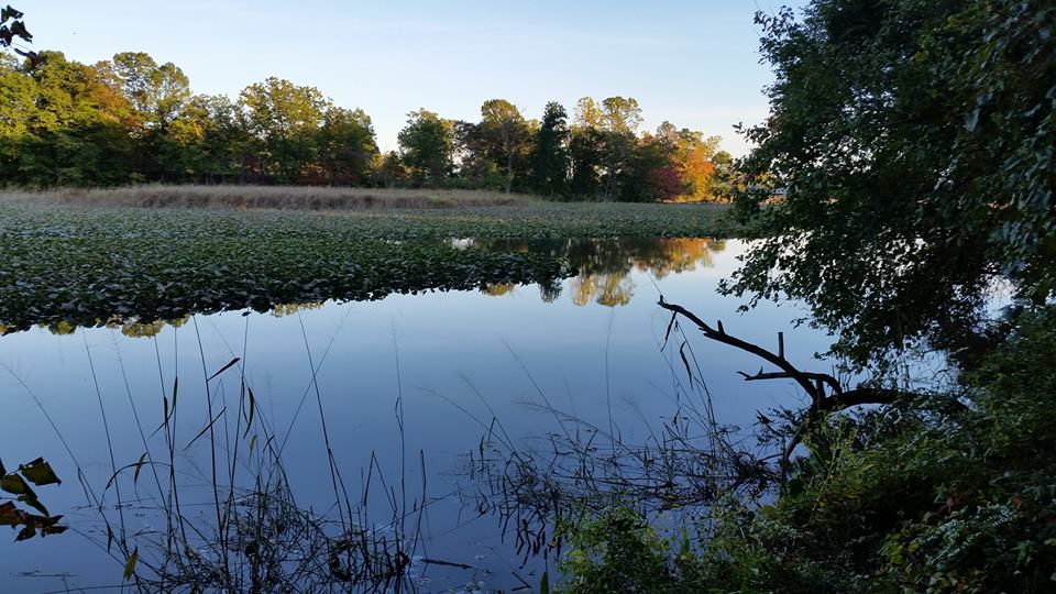
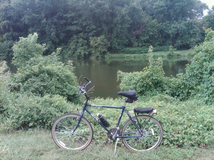
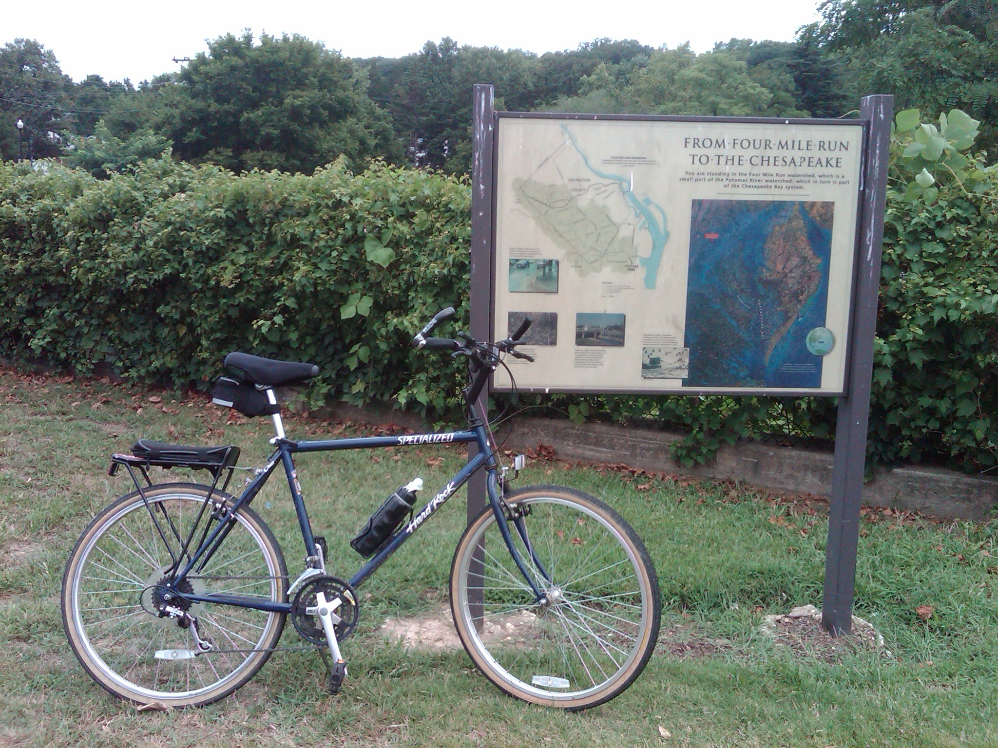
I took advantage of the mild weather preceding the storm expected for this weekend and went for an early morning ride today on a scenic portion of one of the southern sections of the Potomac Heritage National Scenic Trail. The part of the trail where I explored this morning is located about 20 miles south of D.C., between the northern edge of the Julie J. Metz Wetlands Bank just south of Neabsco Creek, and the Occoquan Bay National Wildlife Refuge, in Prince William County, Virginia (MAP).
The trail, also known as the Potomac Heritage Trail or the PHT, is a designated National Scenic Trail corridor spanning parts of the mid-Atlantic and upper southeastern regions of the United States. It is comprised of a network of trails that will eventually connect numerous historic and cultural sites and natural features of the Potomac River corridor in D.C. and the local surrounding area, as well as in the Upper Ohio River Watershed in Western Maryland and Pennsylvania, and a portion of the Rappahannock River Watershed in Virginia.
Unlike many long-distance hiking and biking trails, such as the Appalachian Trail (which the PHT crosses near Harper’s Ferry, West Virginia), the PHT is a general route with numerous side trails and alternative routes. Some of the routes even run parallel to each other, such as the Northern Neck Heritage Trail in Virginia and the Southern Maryland Potomac Heritage Trail, which parallel each other on opposite sides of the Potomac River. The PHT includes approximately 800 miles of existing and planned future sections which, when completed, will all be connected. However, at the present time many of these trails and routes are still separated, connected to the others only by roads.
Development, construction, maintenance and preservation of the natural surface portions of the PHT is sponsored by The Potomac Heritage Trail Association in cooperation with other trail advocacy groups, as well as support from the National Park Service and the Northern Virginia Regional Park Authority. Among the trail advocacy organizations are a number of local groups and clubs, including the Potomac Appalachian Trail Club; Great Falls Trail Blazers; Fairfax Trails and Streams; Southern Prince George’s Trails Coalition; and the Oxon Hill Bicycle Club.
The PHT network follows some of the original paths once explored by George Washington, and you can follow the same routes today. Whether by bike, on foot, or by horse or boat, the PHT provides almost limitless opportunities to explore the contrasting landscapes between the Chesapeake Bay and the Allegheny Highlands, and the many historic sites in between. But if you’re looking for biking opportunities on the PHT which are closer to D.C., try exploring the The C & O Canal Towpath and the Mount Vernon Trail.
[Click on the photos above to view the full size versions]
On this lunchtime bike ride I went for a leisurely ride on the Anacostia Riverwalk Trail, which is located in southeast D.C. and runs along banks of both sides of the Anacostia River (MAP). Although the trail is not yet complete, extensive improvements and additions have been made to the trail in recent years, making it already one of the most scenic and enjoyable trails in the city. To date, 15 of the ultimate 28 miles of the trail are open for use. And completion of the remainder of the trail is a priority project under President Barack Obama’s America’s Great Outdoors Initiative.
In the past one of the trail’s biggest obstacles was the need to cross the CSX railroad tracks, which bisected the trail just north of the John Philip Sousa Bridge on both sides of the river. But that hurdle has been overcome with the relatively recent addition of two fiber-reinforced polymer, weathering steel bridges that allow trail users to cross over the railroad tracks.
The Kenilworth Aquatic Gardens segment of the trail was started in the spring of 2014 and is currently underway. This portion will extend from Benning Road in northeast D.C. to the Anacostia River Trail in Bladensburg, Maryland, and is expected to be completed by Summer 2016. The other remaining segments to complete the Anacostia Riverwalk Trail are being constructed as part of the Buzzard Point Trail Project, South Capitol Street Trail Project, various partner development projects along Maryland and Virginia Avenues in southeast D.C., or, in the case of the National Arboretum segment, by the National Park Service.
Once complete, the trail will provide seamless, scenic travel for cyclists, joggers and pedestrians along the Anacostia River, and access to a number of the city’s treasures along the way, including The Maine Avenue Fish Market, Nationals Park, The Yards Park, Diamond Teague Park, The Titanic Memorial, The Washington Navy Yard, Historic Anacostia, Anacostia Park, Kenilworth Aquatic Gardens, RFK Stadium, and The United States National Arboretum, as well as 16 different communities between the National Mall at the Tidal Basin and Bladensburg Marina Park in Maryland. The trail’s northern end will eventually connect to Maryland’s Anacostia Tributary Trail System for nearly 60 miles of contiguous pathway.
[Click on the thumbnails above to view the full size photos]
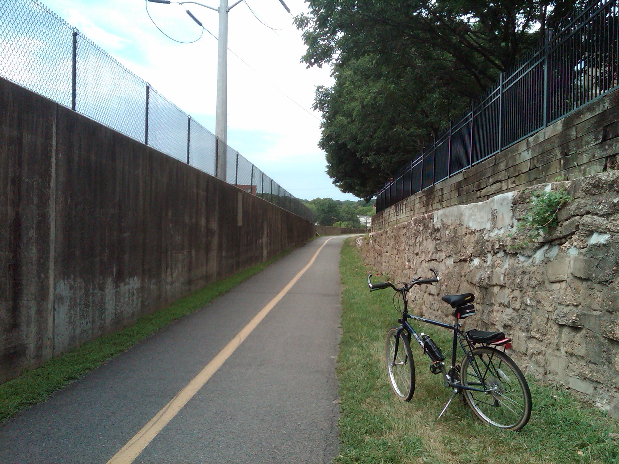
On this lunchtime bike ride I decided to ride out to the Four Mile Run Trail, which is a relatively short, paved bike trail in Northern Virginia. It connects at the eastern end to the Mount Vernon Trail near the southern edge of Ronald Reagan Washington National Airport, and on the western end to to the Bluemont Junction Trail in the similarly named park in the city of Falls Church (MAP). The trail runs along the Four Mile Run, a stream which empties into the Potomac River at the Mount Vernon end of the trail, and runs roughly parallel to parts of the Washington & Old Dominion Railroad Trail as it follows Four Mile Run, sometimes on the other side of the stream.
I initially thought that the Four Mile Run Trail got its name because it is four miles long. Even though that would make the name unimaginative, it seemed to make sense. However, it is a 6.2-mile long trail. Since it runs along a stream named Four Mile Run, I then assumed that although the trail was longer, it got its name from the stream, which must be four miles long. However, the stream, whose eastern section forms the boundary of Arlington County and the City of Alexandria, is 9.4 miles long. This fact made me even more curious about how the Four Mile Run Trail got its name.
Although the origin of the name of the trail is not known for certain, the most widely accepted story alleges that it resulted from someone incorrectly reading an old map. The map listed the name of the stream as “Flour Mill Run”, after one of several watermills which used the stream to process flour. But eventually the letters on the map became affected by creases and fading of the ink, and the Flour Mill Run was misread as Four Mile Run. Over time, the new name stuck. And when the trail was created it was named after the name of the stream as it was now known.
In 2009, an extension to the trail was completed near the Shirlington neighborhood of Arlington. The extension not only linked the Four Mile Run Trail with the eastern end of the Washington & Old Dominion Railroad Trail, but allowed bike riders and other trail users to pass under the Shirley Highway/Interstate 395 and West Glebe Road without having to ride on the usually busy streets of Arlington and Alexandria.
Although relatively short in length, Four Mile Run Trail runs through developed urban areas as well as wetlands, where it crosses the stream in numerous places, and wooded natural areas as well. The trail has many twists and turns, some as much as 180 degrees, and a few short but steep climbs and descents as well. At times you’re likely to see numerous bike riders, runners, dog-walkers and even families, so it can be crowded. But at other times you can traverse the length of the trail and see hardly anyone. So although I can’t tell you what to expect, I highly recommend Four Mile Run Trail.
[Click on the thumbnails above to view the full size photos]
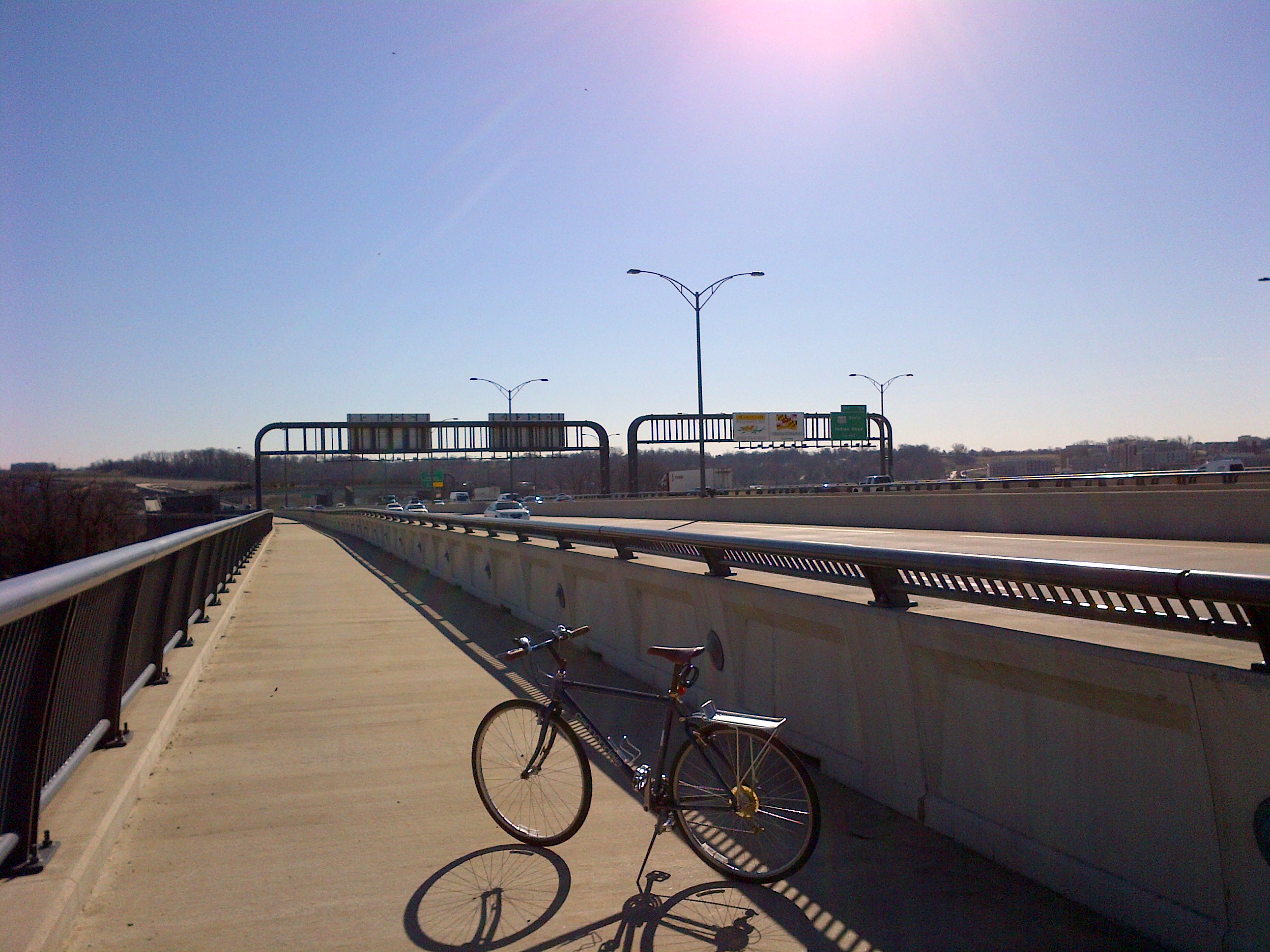
You would think that a mile and a quarter long, multi-span drawbridge which carries a twelve-lane interstate highway used by more than a quarter of a million vehicles every day would not be a very good location for riding a bicycle, but that is not the case with the Woodrow Wilson Memorial Bridge.
The Woodrow Wilson Memorial Bridge, commonly referred to as the Wilson Bridge, was planned and built as part of the Interstate Highway System created by Congress in 1956. Construction of the bridge began in the late 1950s, at which time it was called the Jones Point Bridge. It was renamed the “Woodrow Wilson Memorial Bridge” in honor of our country’s 28th President in 1956 by President Dwight D. Eisenhower as part of that year’s centennial celebration of Woodrow Wilson’s birth on December 28, 1856. President Wilson was an advocate of automobile and highway improvements in the United States, and during his presidency reportedly spent an average of two hours a day riding in his automobile to relax and, as he would say, “loosen his mind from the problems before him.”
The Wilson Bridge opened to traffic on December 28, 1961. First Lady Edith Wilson, the widow of President Wilson, was supposed to have been the guest of honor at the bridge’s dedication ceremony honoring her husband on what would have been his 105th birthday. However, she died that very morning at the family home they had shared in northwest D.C.
The Wilson Bridge as it was originally constructed was designed to handle between 70 and 75 thousand vehicles a day. But by 1999 the bridge was handling 200,000 vehicles a day. This caused not only traffic issues but serious maintenance problems as well. Despite undergoing continuous patchwork maintenance beginning in the 1970’s, and being completely re-decked in 1983, the overuse took its toll and in 2000 construction began to replace the bridge with two new side-by-side drawbridges. The massive $2.357 billion construction project utilized 26 prime contractors and 260 subcontractors employing 1,200 full-time workers. The 230 thousand ton, 1.2-mile long structure was completed almost a decade later.
The Wilson Bridge currently consists of two parallel bridge structures, each with 17 fixed spans and one 270-foot twin double leaf bascule span. The northern span carries the Inner Loop of the Capital Beltway, which is comprised of Interstate 95 and Interstate 495, while the southern span contains the beltway’s Outer Loop. And with eight leaves, each weighing four million pounds, giving the drawbridge 32 million pounds of moving mass, it is the biggest drawbridge in the world.
Connecting the city of Alexandria, Virginia, with National Harbor in Oxon Hill, Prince George’s County, Maryland, the Wilson Bridge also crosses the tip of the southernmost corner of D.C., giving it the distinction of being the only bridge in the United States that crosses the borders of three jurisdictions. The 300-foot mid-span of the western portion of the bridge is also the shortest segment of Interstate Highway between state lines.
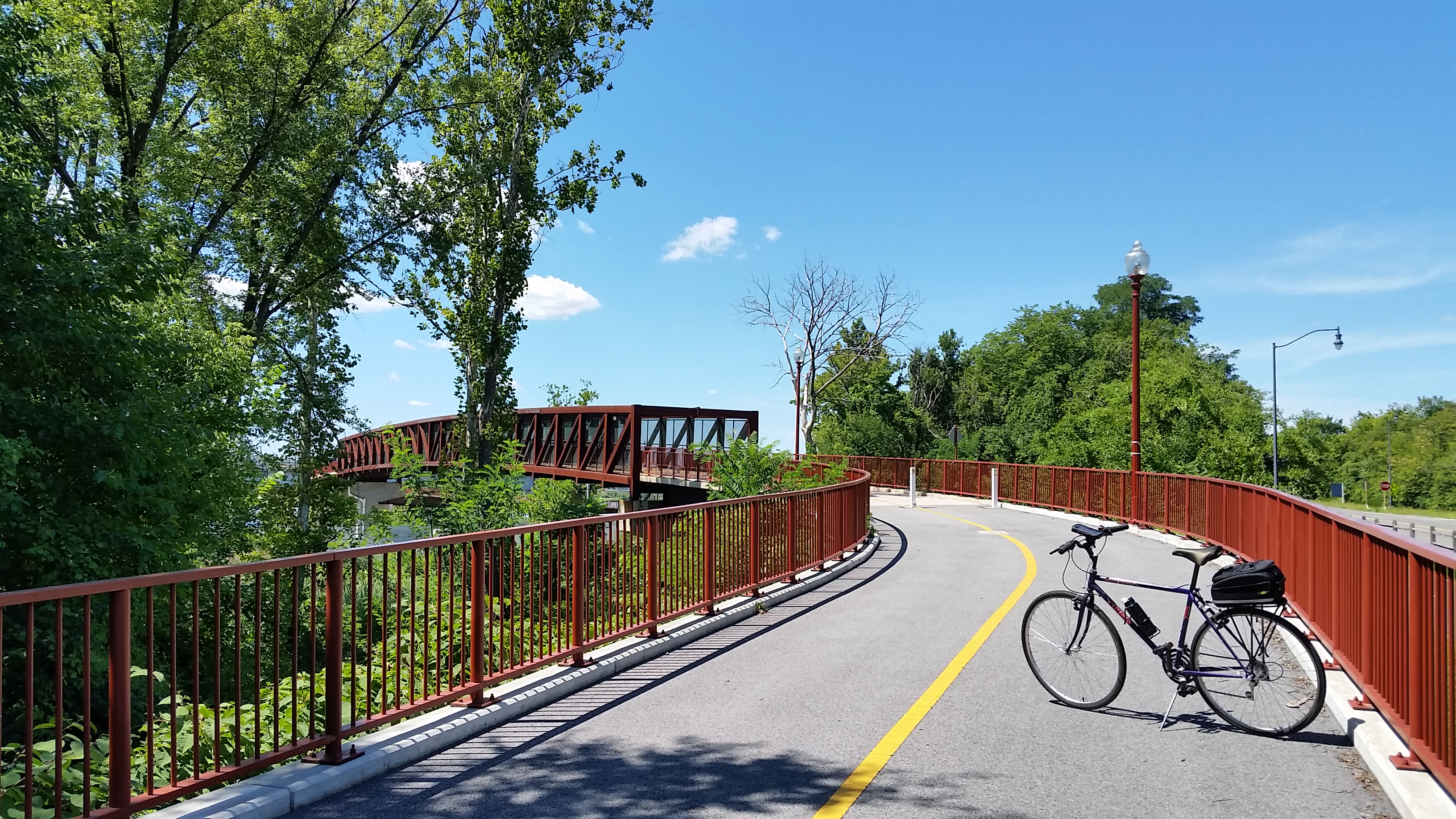
But to me, one of the most impressive features of this massive structure was the forethought to make it bicycle friendly. The northern span of the bridge includes a pedestrian and bike passageway known as the Wilson Bridge Bike Trial. The 3.5-mile trail extends from Oxon Hill Road across the Potomac River to the Huntington Metro Station in Virginia. The trail connects to the network of trails, including the Mount Vernon Trail at Jones Point Park in Virginia. And future plans call for it to connect with the Potomac Heritage Trail in Maryland. The trail has a steel railing on the north side called the bicycle barrier and a concrete barrier with a short steel railing on top called the combination barrier to separate the bikeway traffic from the highway traffic. The trail, which opened on June 6, 2009, is approximately 12 feet wide, with “bump-out” areas where users can stop to observe views of D.C. and Old Town Alexandria.
The Wilson Bridge Bike Trial has a speed limit of 10 m.p.h., which is a good idea due to the bridge’s many steel joints that can damage bike tires and rims at high speeds. The speed limit for bikes is also a good idea since the trail is also used by many pedestrians. While riding on the trail it’s also a good idea to remember that it is a drawbridge and may open periodically, so paying attention to warning lights and bells is necessary. The trail is closed between midnight and 5:30 a.m. It is also closed during snowstorms, so much like the D.C. area, it has had a rough go of it this winter.
[Click on the thumbnails above to view the full size photos]
I am still taking some time off from work after the holidays. And as I’ve written previously in this blog, weekends, holidays and other time off from work provide ideal opportunities to venture away from the city and explore any one of the many local, regional and state parks in the D.C. metro area. For this ride, I took my oldest daughter along and we enjoyed a tandem ride at Burke Lake Park.
Burke Lake Park is located off Interstate 95, approximately a half an hour south of D.C., at 7315 Ox Road in Fairfax Station, Virginia (MAP). The public park is owned by the Fairfax County Park Authority, and was built on 888 acres of land that had been purchased by the Federal government in the 1950s for an international airport. However, when the site where Dulles Airport is now located was chosen as a replacement, the land was developed by Fairfax County as a public park.
The park is open from sunrise to sunset and offers a myriad of activities, including a miniature train, carousel, outdoor volleyball courts, open fields, Frisbee golf, horse shoe pits, an ice cream parlor, picnic areas with grills, three playgrounds, an amphitheater, camping, and a marina and boat rentals for enjoying the main feature of the park, a 218-acre lake owned by the Virginia Department of Game and Inland Fisheries. The park also includes a miniature golf course, as well as an 18-hole par-three golf course, a driving range, and a clubhouse with snack bar.
As if all of these amenities were not already enough, Burke Lake Park also boasts one of the ten best fitness trails in the nation, as named by the American Hiking Society. The Burke Lake Loop Trail follows the shoreline 4.7 miles around the lake, with bays jutting out from the main body of water that provide variations in the trail. Gravel surfaced for most of its length, Burke Lake’s loop trail is not just suitable for walking and running, but is an excellent trail for biking as well.
The Burke Lake Trail Loop is one of the most scenic and enjoyable trails in the D.C. area. The only thing that could make it better is enjoying it with someone special, like I did.
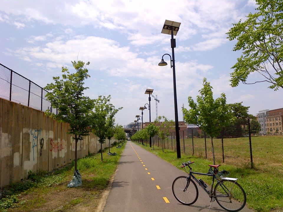
On this ride I explored the Metropolitan Branch Trail, which is an eight-mile trail that runs through the middle of D.C. (MAP), from Union Station downtown all the way to the Baltimore and Ohio (B&O) Railroad Station in Silver Spring, Maryland. Seven miles of the trail are within the city limits, and one mile is in Maryland. The trail gets its name from the Metropolitan Branch Line of the B&O Railroad, which the trail parallels. It is technically considered a rail-trail conversion because a key section of the trail is on former B&O Railroad right-of-way.
The urban trail takes cyclists past graffiti, industrial sites, train tracks, a brewery, and a touch of greenery as it passes through several of D.C.’s vibrant and historic neighborhoods, including the NOMA, Edgewood, Eckington and Brookland neighborhoods. Used much more for utilitarian purposes than for recreation, the trail is an important transportation route providing connections to homes and work, as well as access to seven Metro stations, and the National Mall.
However, the Metropolitan Branch Trail currently remains unfinished. Plans for the future include connections to the area’s trail network such as the Capital Crescent Trail, Anacostia Trails System, and integration into the East Coast Greenway.
[Click on the thumbnails above to view the full size photos]
The Washington & Old Dominion Railroad Regional Park is one of the skinniest but one of the longest parks in the commonwealth of Virginia. It is a regional park in Northern Virginia that is 44.8 miles long but only about 100 feet wide. The park encompasses the Washington & Old Dominion (W&OD) Railroad Trail, which is a nearly 45-mile asphalt-surfaced paved rail trail that runs through densely populated urban and suburban communities like the villages of Falls Church and Leesburg, high-tech centers such as Reston and Herndon, as well as through rural areas. The park and its trails are administered and maintained by the Northern Virginia Regional Park Authority (NVRPA), with the assistance of The Friends of the Washington and Old Dominion Trail, a non-profit citizens organization dedicated to the preservation, enhancement and promotion of the trail.
The W&OD Trail begins in the Shirlington neighborhood of Arlington County, Virginia, near the intersection of South Shirlington Road and South Four Mile Run Drive (MAP). At its trailhead, it connects to the paved Four Mile Run Trail, which travels eastward through Arlington along a stream embankment to meet the Mount Vernon Trail at Ronald Reagan Washington National Airport, near the Potomac River. This makes it easily accessible via the 14th Street Bridge for riders from D.C. In fact, with the ability to then connect to the Rock Creek Park Trail, and then the Chesapeak & Ohio Canal and Towpath and the Great Alleghany Passage, it is possisble to travel from Purcelville to D.C., and then all the way to Pittsburgh, Pennsylvania, a distance of 380 miles, entirely on trails without ever having to encounter cars or other motorized vehicle traffic.
The trail takes its name from the former Washington and Old Dominion Railroad, whose trains ran along the right-of-way from 1859 until 1968. The trail now travels on top of the rail bed of the former railroad. When the railroad ceased operations, the local power company bought the right-of-way for its electric power lines. After years of trying, the NVRPA was eventually able to acquire the use of sections of the railroad right-of-way for the trail. The first section of the W&OD Trail was opened in 1974 within the City of Falls Church. The multiuse trail proved to be so popular that the remaining sections were built, until its completion to Purcellville in 1988. The final section of the trail and near Arlington’s Bluemont Park was finally added in 2002. But even before its completion, it proved to be so popular that in 1987 the W&OD was designated a National Recreation Trail by the U.S. Department of the Interior.
Along the trail are numerous attractions and sites to keep the ride interesting, including several former railroad stations and cabooses, as well as bridges, museums, an old lime kiln, stores, bike shops, and old Victorian houses visible from the trail. Numerous streams, wetlands, overlooks, culverts, and green spaces are also located along the W&OD, which are home a variety of plant life, including hundreds of species of wildflowers. Over 100 species of birds, as well as mammals such as foxes, river otters and beavers, and reptiles such as turtles and snakes also inhabit these areas. With few hills, the W&OD Trail is a perfect venue for a bike outing. And in stark contrast to riding in D.C., there is no vehicle traffic along the entire route.
[Click on the photos to view the full-size versions]