Archive for the ‘Destinations’ Category

OBXbike

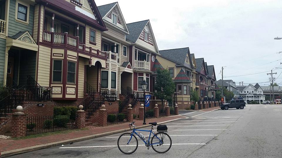
OBX Bicycle, Kill Devil Hills, NC

I first started going to the Outer Banks of North Carolina with a group of college friends in the 80’s.  Then my Mom started a tradition of holding family reunions there for me and my five siblings, and our families.  I went there every year for decades.  But I had not been back since my Mom passed away, until last week that is.  Last week my family joined my brothers and sisters and their spouses, and their children and their children’s spouses, and their children’s children, and spent the week on the Outer Banks.

It was a fantastic week of family, food and fun.  Unfortunately, due to a combination of a full schedule of activities and extreme heat advisories issued by the National Weather Service, I was not able to get in as much bike riding as I had originally hoped.  On the days when it was possible I enjoyed riding a beach cruiser (although it took some time to get used to using coaster brakes again).  I even stopped by one of my favorite local bike shops on the Outer Banks, OBX Bicycle.

Although I was not able to ride as much as I would have liked on this trip, I have another trip planned which will consist almost entirely of riding.  When I retire I plan to go long-distance bike touring in several areas around the country, including the Outer Banks.  And depending on how those tours go, I may go on a bike tour across the country.

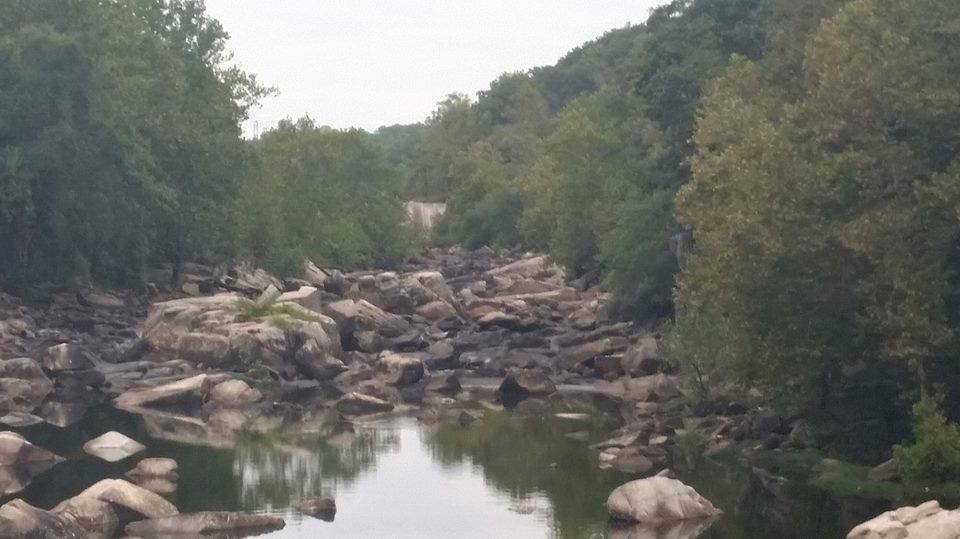
In fact, I have already researched, developed plans for, and mapped out my bike tour of the Outer Banks.  It begins at the northernmost lighthouse in Corolla, and goes south through the barrier islands before circling back through the coastal plains and returning to where it began.  The tour will include all of the lighthouses along the scenic coast, as well as historic sites, national memorials, state parks, marshlands, wildlife refuges, estuarine reserves and national forests.  It will also include some of the best restaurants and breweries in the country.

To find out more about my plans for bike touring on the Outer Banks before I go, click here.  To find out about it as it happens, just keep reading this blog.

This Year’s Cherry Blossoms Watch

On of the favorite local early-spring pastimes in the D.C. area is the “cherry blossom watch.”  This involves observing the progress of the Yoshino cherry trees surrounding the Tidal Basin as they approach “peak bloom.”  Peak bloom is traditionally defined as the day when 70 percent of the blossoms are open on the famous trees.  But because approximately half the blossoms on the trees were killed when unseasonably cold weather returned just as they were about to reach peak bloom, that didn’t happen.  Instead, this year definition had to be slightly altered.  Officials defined peak bloom for 2017 as the day 70 percent of the remaining blossoms were open.  And that occurred a few days ago.

As expected, the bloom this year was a little more subdued than usual simply because of the diminished number of buds that survived the weather.  However, the trees put on a beautiful show nonetheless.  Over the past few days since the peak bloom the blossoms have gradually been going from white to their iconic pale pink.  But the blossoms are also becoming quite fragile.  And with a prediction of one hundred percent chance of rain tomorrow, the rain will most likely knock the remaining petals off and blanketing the ground with so many petals it looks like blossom snow.

If it’s possible for you to get down here to the Tidal Basin by the end of the day today, you will still be able to see the last part of this year ‘s blooming cycle.  Otherwise, I hope you will enjoy the following photos that I took this year.  You can also see  my blog posts with photos of the cherry blossoms from previous years.


 [Click on the photos to view the full-size versions]

occoquan01

The Historic Town of Occoquan

With traffic and transit changes anticipated in D.C. because of the long Columbus Day holiday weekend, for this bike ride I chose to go outside of the city.  For this excursion I chose the historic town of Occoquan, located approximately 23 miles south of D.C. in Prince William County, Virginia (MAP).  It is situated on the south bank at the fall line of the Occoquan River, and directly across the river from the Occoquan Regional Park and the Lorton Correctional Facility Beehive Brick Kiln.  With access available via road, river and the East Coast Greenway, it is accessible by car, boat, foot traffic, and by bike.

The town derives its name from an Algonquian Doeg Indian word, meaning “at the end of the water”.  And throughout its existence the river has been its lifeblood.  It was its location on the water which attracted and then sustained its original occupants, indigenous people who relied upon the river for fish and sustenance.  Similarly, for the British and subsequently American colonists who came after them, the river provided an ideal site to for transportation and trade.   A tobacco warehouse was built as early as 1736, and an industrial complex began in 1750.  Within the next several decades Occoquan had iron-manufacturing, a timber trade, quarrying, river-ice, shipbuilding, a bake house, saw mills, warehouses, and Merchant’s Mill, the first automated grist mill in the country.  It operated for 175 years until destroyed by fire.  Later, during the Civil War, the Occoquan Post Office passed letters and packages between North and South.  But eventually river silting and the shift in traffic to railroads reduced ship traffic to Occoquan and ended its days as a port.

Reflecting the rich history of Occoquan, a number of structures in town, including a number in the downtown commercial area, are part of the Occoquan Historic District which is listed on the National Register of Historic Places.  One of the more prominent examples of these structures is Rockledge, the former house of the town’s founder, which sits on an overlook above the town.

But the town has not only survived.  It has thrived.  Today, it is a restored artists’ community, with an eclectic collection of over one hundred specialty shops offering everything from antiques, arts, crafts, fashions, to unique gifts.  The town also offers a public park complete with a gazebo, a town boat dock, a museum, guided ghost walks, and a full array of dining choices, from ice cream and snack stands to a five star restaurant.  And everything is within walking distance, with much of it adjacent to the river.

It was still dark when I arrived this morning, but I found a place named Mom’s Apple Pie Bakery that was already open.  So I indulged in a piece of Shenandoah Peach Pie, which I took down to the waterfront and enjoyed for breakfast as the sun was coming up.  I also purchased a jar of locally-made fresh pumpkin butter to take home.   The bakery, the riverfront, and the entire town were all fun to explore, and a great way to begin Columbus Day, named after a great explorer.

occoquan00     occoquan03     occoquan02

occoquan10     occoquan11     occoquan12

occoquan13     occoquan04     occoquan07

occoquan06a    occoquan05    occoquan09a    occoquan08

occoquan14     occoquan15     occoquan16

occoquan18     occoquan19a     occoquan20

occoquan17
[Click on the photos to view the full-size versions]

AmericanMeridian01

The American Meridian Memorial

As I was riding around the campus of George Washington University on this lunchtime bike ride, I happened upon a marker that I hadn’t seen before. As I would come to find out, it is The American Meridian Memorial.  Located on a small bluff near the corner of 24th and H Streets (MAP) in northwest D.C.’s Foggy Bottom Neighborhood, it was once considered by some to be the center of the world, establishing a geographical line that separated the Eastern and Western hemispheres. 

Prior to 1850, different countries measured longitude from different meridians. Because there was no agreement for a prime meridian, the way there is with latitude and the Equator, prime meridians and associated maps were identified in Greenwich, Paris, Rome, and various other European centers. American navigators tended to use either the French meridian at Paris or the British meridian at Greenwich.

Beginning in 1850, the United States established and began to measure distance from the American Meridian. The Federal government officially used this line, which ran along 24th Street, to measure distances on land, survey the West, coordinate the nation’s clocks, and record the start of new days.

However, few navigators at that time adopted the American Meridian, as they owned charts that gave distances relative to Paris or London, rather than 24th Street in D.C.  In fact, the United States continued to utilize the Greenwich Meridian for longitude at sea. But land surveyors welcomed the ability to measure from the new American Meridian rather that a line that lay across a broad ocean.  So as teams of American surveyors and mapmakers ventured steadily westward, those square boundaries of the Western states were all measured in appealing round numbers from the American Meridian.

Oregon would be the first to use the American Meridian in 1859 when it became a state. The southeastern border of the new state would be exactly 42 degrees West of the American Meridian. Colorado Territory in 1861 would be next to use the Meridian, establishing it’s eastern (27°W, Am) and western (34°W, Am) borders with the newly established meridian. The eastern border of Wyoming is exactly 27 degrees west of 24th Street, Arizona is 32 degrees west, and the Utah-Nevada border is 36 degrees west

The United States, via an act of Congress, officially abandoned the American Meridian in 1912, when it accepted the meridian at Greenwich as the international standard. Thus, the American Meridian was relegated to history. Today, the meridian marker is one of three reminders in D.C. of the evolution of cartography in this country. Meridian Hill Park was named for a stone obelisk that was erected there along the original prime meridian in 1804.  The stone marker there is long gone, but the park named after it remains.  And the third remnant of the pre-Greenwich Meridian age is The Zero Milestone, which is located on The Ellipse directly south of The White House.  With the advancement of technology, one day the Greenwich Meridian may be a thing of the past as well.

AmericanMeridian02[Click on the photos to view the full-size versions]

The Ice Skating Rink at the National Gallery of Art Sculpture Garden

The Ice Skating Rink at the National Gallery of Art Sculpture Garden

The circular reflecting pool at the center of the National Gallery of Art’s Sculpture Garden is transformed during the cold winter months each year into an outdoor ice skating rink. It has become an extremely popular winter destination, particularly for skating enthusiasts. And although I am not an ice skater myself, it was also my destination, at least for this lunchtime bike ride.

Ice skating has been a popular activity on the National Mall for well over a hundred years, with unofficial skating sites located at the Tidal Basin and The Reflecting Pool in the nineteenth and early twentieth centuries. However, the actual ice skating rink did not open until 1974. And it did not open in its current form until 1999. Because the ice rink had been operating at the site since for more than twenty years, it was included in the National Gallery of Art’s plans for the Sculpture Garden when it was conceived in 1996.

In its current location as part of the Sculpture Garden, visitors have the opportunity to skate while surrounded not only by the grand architecture of national museums and monuments, but by large outdoor sculptures and exhibits displayed by the National Gallery of Art. These sculptures include works by world-renowned artists, such as “Four-Sided Pyramid” by Sol LeWitt and Claes Oldenburg’s “Typewriter Eraser, Scale X“, to name just a couple. In all, there are nineteen works of modern and contemporary sculpture on the richly landscaped grounds surrounding the ice rink.

The ice rink can accommodate more than two hundred skaters, with a music system that brings vibrant sound to visitors on and off the ice. And at night, lighting further contributes to the festive atmosphere. This year, the gallery’s guest services will offer both skating and ice hockey lessons, for which students can register individually or with a group. There is also a snack shop named the Pavilion Café, which offers a panoramic view of the Sculpture Garden and ice rink in addition to a variety of food and beverages.

Located just off the National Mall at 700 Constitution Avenue (MAP) in downtown, D.C., the ice rink opened in mid-November and will remain open through March 16, 2015, weather permitting. The rink is open Monday through Thursday from 10 a.m. to 9 p.m., and Friday and Saturday from 10 a.m. to 11 p.m. On Sunday, it’s open from 11 a.m. until 9 p.m. The ice-skating rink will close at 5:00 p.m. Christmas Eve, and will be closed on December 25 and January 1. Admission for a two hour session costs $8 for adults. And if you don’t have your own skates, they can be rented for an additional $3. A season pass that covers unlimited access to the ice rink is also available for $195.

Whether you’re an avid skater or have never tried it before, I highly recommend visiting the National Gallery of Art Sculpture Garden Ice Skating Rink at least once this winter. Who knows, you may enjoy it so much that, like many other people already have, you’ll want to make it an annual winter tradition.

IceSkatingRink03

National Harbor

National Harbor

On this bike ride I decided to go on a longer ride than usual, and made the 30-mile round trip out and back to National Harbor in Maryland. National Harbor is a 300-acre multi-use waterfront development on the shores of the Potomac River in Prince George’s County, Maryland, south of D.C. near the Woodrow Wilson Bridge. Its official address is 165 Waterfront Street in National Harbor, Maryland (MAP).

The land developed for National Harbor was previously the site of the Salubria Plantation. Originally built in 1827 by Dr. John H. Bayne, the site was renowned by local historians for its connection to Black history and to the Civil War. It was on the Salubria Plantation in 1834 that a 14-year-old slave girl named Juda, thought to have possibly been influenced by Nat Turner’s slave rebellion a few years earlier, poisoned her master’s two sons and infant daughter, and attempted to burn the house down, as an act of resistance to slavery. She is listed in the Maryland Archive as the first Maryland woman who was reported to have resisted slavery. She was tried and hanged in nearby Upper Marlborough, thus earning the dubious distinction of being the youngest female ever executed in the United States.

Despite the murders of his children, Dr. John Bayne became a Union officer in the Civil War, and went on to help convince the state of Maryland to compensate slave owners to free their slaves. He also later worked to provide public education to freedmen.

Despite being called “Hallowed African American Ground” in a headline by The Washington Business Journal, the site lost its historical designation and opportunity to be listed on the National Register of Historic Places when the plantation house burned down in 1981. Despite Prince Georges County being a majority Black county which ranks as the most educated and affluent Black county in the United States, a vote was taken by the Historic Preservation Commission to take away, not to nominate it for the national register. The remains of the plantation were then offered for sale along with the surrounding land. It sold in 1984, and was subsequently rezoned for mixed-use development.

Now known as National Harbor, the site has a convention center, six hotels, restaurants, condominiums, museums, stores, and an outlet mall. The site also has amusement rides, including a children’s carousel, and the Capital Wheel, a 175-foot ferris wheel on a pier that extends out into the Potomac River. National Harbor also includes a beachfront, where an outdoor sculpture entitled “The Awakening” currently resides, and a walking path. And an MGM-branded casino is expected to open at National Harbor within the next couple of years. It also hosts outdoor activities such as a culinary festival, famers markets, concerts by local artists, an annual ice sculpture exhibition, and an annual international Beatles festival.

However, access to National Harbor remains an issue. National Harbor has road access to Interstate 95/495 (the Beltway), Interstate 295 (Anacostia Freeway), and Oxon Hill Road. The state of Maryland has funded over a half a billion dollars in road improvements in order to handle the number of vehicles expected to drive daily to National Harbor. Since National Harbor is not accessible by the Metro, the Washington area’s rapid transit system, the state of Maryland also pays approximatley $312,000 annually for bus access to National Harbor from the Branch Avenue Metro station. A water taxi line run by the Potomac Riverboat Company also connects the National Harbor to Alexandria, Virginia. The City of Alexandria also runs shuttles from the water taxi terminal to the King Street/Old Town Metro station. The service costs the city almost a million dollars each year. Despite the government subsidies, National Harbor remains difficult to access via public transportation. I did, however, find it to be accessible by bike via the separated bike lane that crosses the Woodrow Wilson Bridge, but lacking in secure parking and storage facilities for your bike once you arrive.

     NationalHarbor05     NationalHarbor01      NationalHarbor04

NationalHarbor03     NationalHarbor06     NationalHarbor07


Kingman and Heritage Islands Park

Kingman and Heritage Islands Park

On this bike ride I set off with no particular destination in mind. I initially rode to Southeast D.C., and then started following the Anacostia Riverwalk Trail. As I was riding past the Redskins’ old home at R.F.K. Stadium, there was a turn off on the trail that went through a gate and disappeared into the woods. So naturally I turned to follow it. As I followed the path I discovered it was the entrance to Kingman and Heritage Islands Park. I later discovered that there is also an entrance on the other side of the park, on Benning Road in D.C.’s Anacostia neighborhood.

Heritage Island and Kingman Island are located Southeast and Northeast D.C., in the Anacostia River. Kingman Island is bordered on the east by the Anacostia River, a tributary of the Potomac River, and on the west by Kingman Lake, while Heritage Island is surrounded by Kingman Lake (MAP). This makes both accessible to be explored by boat. The islands were developed from sediment dredged from the bottom of the Anacostia River. Additionally, the wetlands found around the edges of Kingman Lake were developed and constructed by the Army Corps of Engineers and several other partner organizations. The islands were federally owned property managed by the National Park Service from the time they were constructed in 1916, until they were turned over to the District of Columbia government in 1995.

The park is comprised of over 50 acres of natural area to be explored on these two island habitats.  Riparian wooded areas, river views, and wetlands comprise much of the sights to be experienced, where a variety of flora and fauna native to the area can be viewed.  And the area is an ideal spot for birdwatching as well.  Over 100 species of birds have been identified at the park including Bald Eagle, Great Blue Heron, Great Egret, and osprey.  The islands are home to many different types of animals as well, including beavers who can be observed build dams and foxes excavate holes.  And the Kingman Island Trail provides over a mile and a half of paths for walking, hiking, and bike riding.

Interestingly, once each year the serene character of these islands is interrupted for the annual Kingman Island Bluegrass and Folk Festival, which draws up to 10,000 people to the oft-forgotten green oasis. Attendees bring lawn chairs and sunscreen, and sprawl in the sun for an afternoon of live music that is the biggest fund-raiser for the Living Classrooms Foundation of the National Capital Region, which currently maintains the islands along with the D.C. Office of the Deputy Mayor for Planning and Economic Development.

Despite numerous efforts to develop the area over the last 100 years, the southern half of Kingman Island and all of Heritage Island remained largely undeveloped. A variety of proposals have been made in recent years, most focusing on retaining the islands’ character as one of the few remaining wild places within the city’s limits. As such, it continues to remain largely unknown, which makes it an ideal location for riding completely undisturbed, as I did on this ride.

HeritageKingmanIslands01     HeritageKingmanIslands06     HeritageKingmanIslands04

HeritageKingmanIslands05     HeritageKingmanIslands03     HeritageKingmanIslands08     HeritageKingmanIslands07
[Click on the photos to view the full-size versions]

The Cherry Blossoms Around The Tidal Basin

The Cherry Blossoms Around The Tidal Basin

Of the numerous and varied attractions worth visiting in D.C. and the surrounding area, most are permanent fixtures.  The monunments and memorials, the statues and museums, the buildings and parks – all are available and routinely visited year round.  But one of the capitol city’s biggest attractions is one of the few that is temporary in nature.  Occurring for only a few days each spring, the blooming of the cherry trees surrounding the Tidal Basin is one of the biggest attractions in the city, bringing in visitors from around the country and around the world.

The cherry trees have been a fixture in D.C. for just over a century, but not as long as originally planned.  In the summer of 1909, the Embassy of Japan informed the U.S. Department of State that the city of Tokyo intended to donate 2,000 cherry trees to the United States.  However, when the trees arrived the following year, the inspection team from the Department of Agriculture found that the trees were infested with insects and roundworms, and recommended that the trees be destroyed.  President William Howard Taft subsequently gave the order to burn the trees.

Two years later, a total of 3,020 replacement cherry trees consisting of 12 different species were shipped on Valentines Day, and subsequently arrived in D.C. on March 26.   In a ceremony the following day, First Lady Helen Taft and the wife of the Japanese ambassador planted the first two of these trees on the north bank of the Tidal Basin in West Potomac Park.  Today, these original two trees still stand at the terminus of 17th Street Southwest, marked by a large plaque.  A few years later, the United States government responded with a gift of flowering dogwood trees to the people of Japan.

From 1913 to 1920, trees of the Somei-Yoshino variety, which comprised 1800 of the gift, were planted around the Tidal Basin. Trees of the other 11 species, and the remaining Yoshinos, were planted in East Potomac Park.  In 1965, Japan gifted additional Yoshino trees, many of which were subsequently planted on the grounds of The Washington Monument.  Since then, the number of trees has expanded to approximately 3,750 trees of 16 species in three National Park Service locations – the Tidal Basin in West Potomac Park, East Potomac Park, and on the grounds of the Washington Monument.

CherryBlossoms03     CherryBlossoms02     CherryBlossoms04

CherryBlossoms05     CherryBlossoms06     CherryBlossoms07
[Click on the photos to view the full-size versions]

The Cherry Trees Collection at the National Arboretum

The Cherry Trees Collection at the National Arboretum

In 1912, the people of Japan sent 3,020 cherry trees to the U.S. as a gift of friendship. Those trees were planted around the Tidal Basin in D.C. Since that time, when people in this country hear the words “cherry blossom,” they often think of the trees made famous by that historic planting. There are now approximately 3,750 trees. In addition to the Tidal Basin, they are located nearby in East Potomac Park and on the grounds of The Washington Monument as well. When it comes to cherry trees, the area near the Tidal Basin is definitely the place to go for quantity.

Although most of the cherry trees around the Tidal Basin area are the familiar Yoshino Cherry, there are 11 other species there as well. They are the Kwanzan Cherry, Akebono Cherry, Takesimensis Cherry, Usuzumi Cherry, Weeping Japanese Cherry, Sargent Cherry, Autumn Flowering Cherry, Fugenzo Cherry, Afterglow Cherry, Shirofugen Cherry and Okame Cherry. However, there are also numerous other species of these ornamental Prunus that offer a diversity of flower color, bloom time, and shape.  So on a recent bike ride I went to the United States National Arboretum in northeast D.C. to see some of these trees that are not available downtown.  The Arboretum has all 12 of the cherry tree species that are downtown, as well as 64 more. And the cherry trees at the National Arboretum are incredible specimens. So if you’re looking for quality and variety, I recommend the National Arboretum.

The National Arboretum displays 446 acres of different trees, shrubs and plants and is one of the largest arboretums in the country. Visitors enjoy a variety of exhibits from formal landscaped gardens to the Gotelli Dwarf and slow growing Conifer Collection. The National Arboretum is most known for its bonsai collection.  Other special displays include seasonal exhibits, aquatic plants, and a National Herb garden. However, during this time of year, the site is an excellent but relatively little-known spot to see cherry trees. They currently have 76 varieties of cherry trees in the research and display collections there. And you can take a self-guided, self-paced tour and explore the acres of flowering cherry trees by bike, by foot, or by car.

The tour, aptly named the “Beyond the Tidal Basin Tour,” introduces visitors to a wide range of flowering cherries. You can see flowers in peak bloom on only some of the trees though, as different types of cherry trees have different bloom times. Many of the trees are in full bloom, but there are some that have already bloomed this season and lost their petals, while others are only beginning to bud. You should be aware that cherry trees have other ornamental features, such as trunk shape or ornamental bark, so be sure to look at the whole tree so you can appreciate the differing qualities as well as the different blooms.

For centuries, the Japanese have valued the ornamental qualities of flowering cherries, equating the transient beauty of the blossoms with the brevity of human life. I’d encourage everyone to visit the National Arboretum at some point in their life. And life is short, so don’t put it off for too long. It’s okay if you can’t come in the Spring to see the cherry trees. It’s worth coming at any time of the year.

Arboretum 02   Arboretum 03   Arboretum 04   Arboretum 05

Arboretum 07   Arboretum 06   Arboretum 08   Arboretum 09

Arboretum 10   Arboretum 11