
Four Mile Run Trail
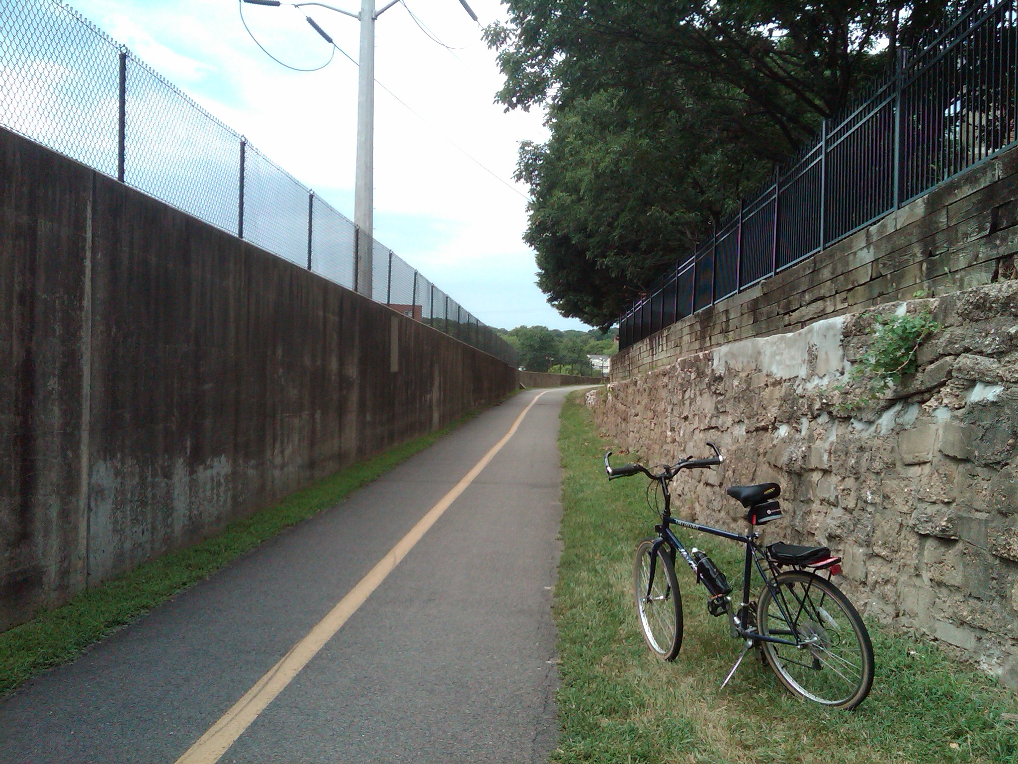
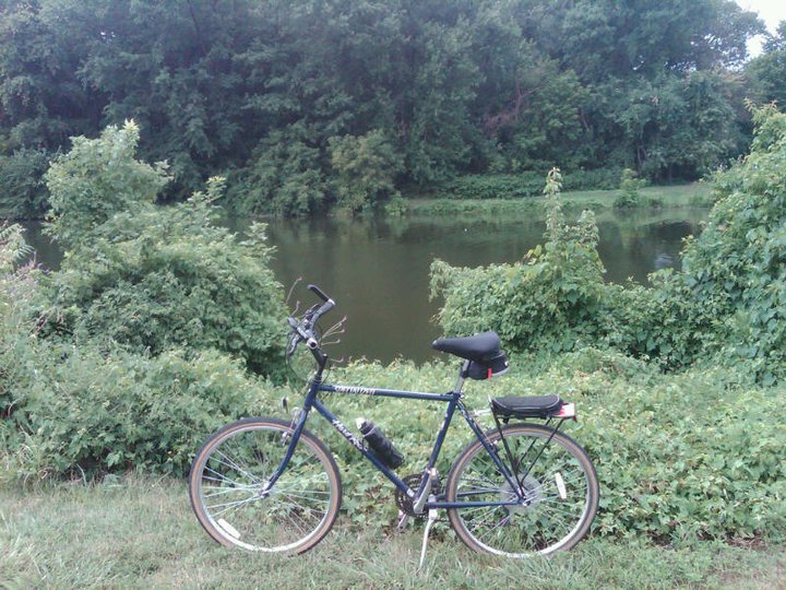
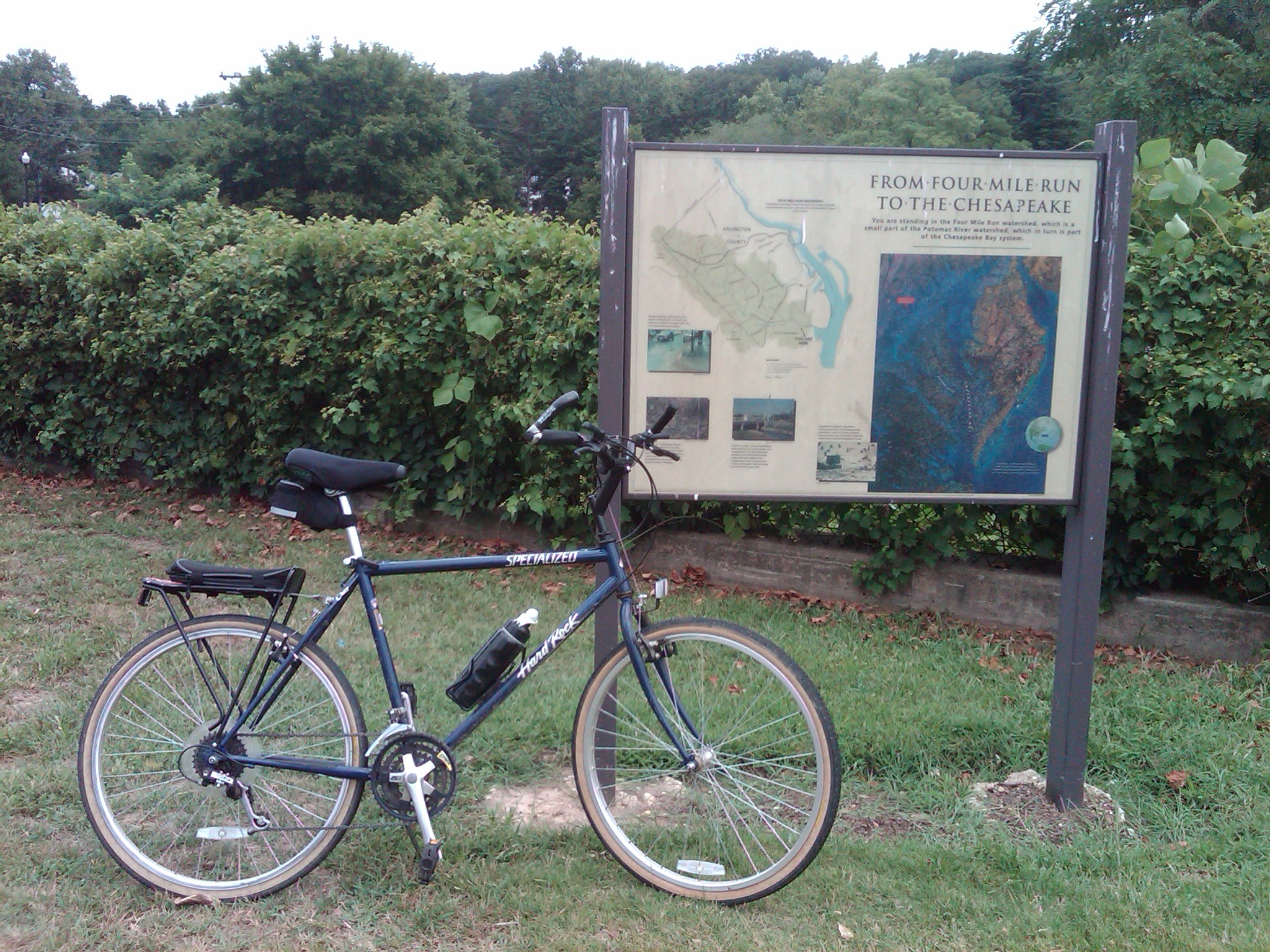
On this lunchtime bike ride I decided to ride out to the Four Mile Run Trail, which is a relatively short, paved bike trail in Northern Virginia. It connects at the eastern end to the Mount Vernon Trail near the southern edge of Ronald Reagan Washington National Airport, and on the western end to to the Bluemont Junction Trail in the similarly named park in the city of Falls Church (MAP). The trail runs along the Four Mile Run, a stream which empties into the Potomac River at the Mount Vernon end of the trail, and runs roughly parallel to parts of the Washington & Old Dominion Railroad Trail as it follows Four Mile Run, sometimes on the other side of the stream.
I initially thought that the Four Mile Run Trail got its name because it is four miles long. Even though that would make the name unimaginative, it seemed to make sense. However, it is a 6.2-mile long trail. Since it runs along a stream named Four Mile Run, I then assumed that although the trail was longer, it got its name from the stream, which must be four miles long. However, the stream, whose eastern section forms the boundary of Arlington County and the City of Alexandria, is 9.4 miles long. This fact made me even more curious about how the Four Mile Run Trail got its name.
Although the origin of the name of the trail is not known for certain, the most widely accepted story alleges that it resulted from someone incorrectly reading an old map. The map listed the name of the stream as “Flour Mill Run”, after one of several watermills which used the stream to process flour. But eventually the letters on the map became affected by creases and fading of the ink, and the Flour Mill Run was misread as Four Mile Run. Over time, the new name stuck. And when the trail was created it was named after the name of the stream as it was now known.
In 2009, an extension to the trail was completed near the Shirlington neighborhood of Arlington. The extension not only linked the Four Mile Run Trail with the eastern end of the Washington & Old Dominion Railroad Trail, but allowed bike riders and other trail users to pass under the Shirley Highway/Interstate 395 and West Glebe Road without having to ride on the usually busy streets of Arlington and Alexandria.
Although relatively short in length, Four Mile Run Trail runs through developed urban areas as well as wetlands, where it crosses the stream in numerous places, and wooded natural areas as well. The trail has many twists and turns, some as much as 180 degrees, and a few short but steep climbs and descents as well. At times you’re likely to see numerous bike riders, runners, dog-walkers and even families, so it can be crowded. But at other times you can traverse the length of the trail and see hardly anyone. So although I can’t tell you what to expect, I highly recommend Four Mile Run Trail.


[Click on the thumbnails above to view the full size photos]
